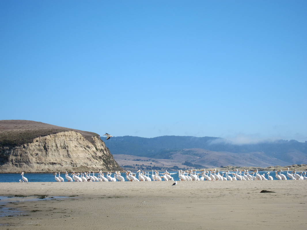
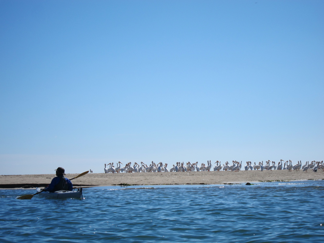
Limantour Spit covered in white pelicans.
Estero: "small river," "marsh," or "estuary" in Spanish. I looked it up before agreeing to go on the trip. "Drakes" because it's the likely landing spot of Sir Francis Drake in 1579 during his circumnavigation of the world (thank you, wikipedia). We departed from the Drakes Bay Oyster Company around 10am. The Oyster Company manages a pretty extensive network of wooden racks with oyster beds throughout the Estero - when the tide reached a certain water level, we kept scraping the bottoms of our boats on wooden poles just below the surface. There's a lot of controversy surrounding the company -- oyster collection disturbs seal pups, covers eelgrass beds, and leaves some plastic waste floating around the estuary.
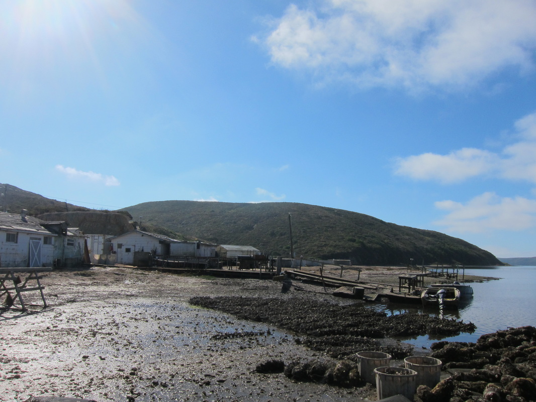
Drakes Bay Oyster Company
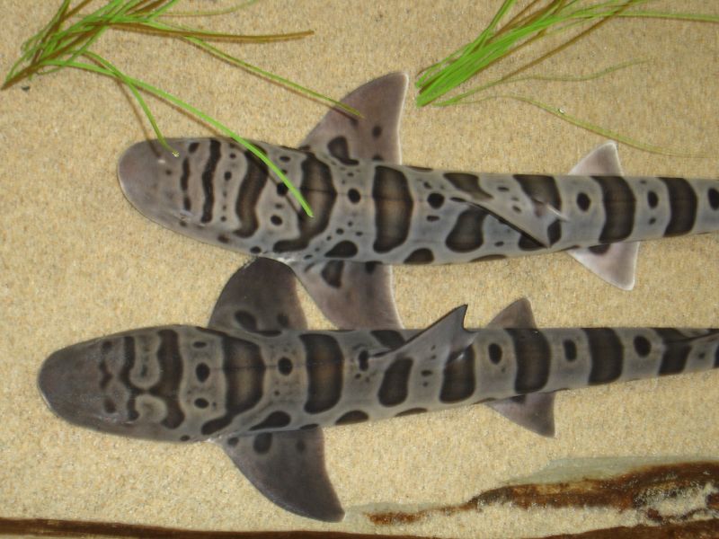
| On the way out towards the ocean we turned left into Home Bay, where we discovered a number of bat rays, leopard sharks, jellyfish, and harbor seals. It was my first time seeing a shark from my kayak. Apparently they're harmless to humans, which makes this slightly less exciting. They eat clams, shrimp, worms, and other non-human things. They're native to the west coast (from Mexico to Oregon), and can usually be found in pretty shallow water. Here's what they looked like from my viewpoint (Source) --> | 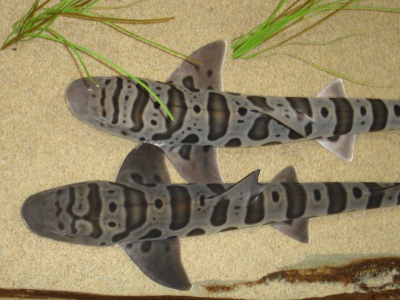 Leopard sharks - so pretty! |
The lunch destination was "Limantour Spit," which is the narrow strip of beach that almost cuts the estero off from the greater Drakes Bay (a wide bay on the Pacific Ocean, just south of Point Reyes). The spit was covered in white Pelicans.
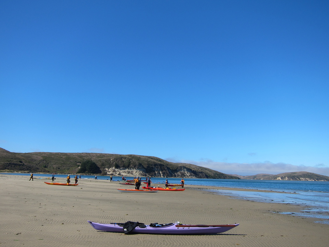
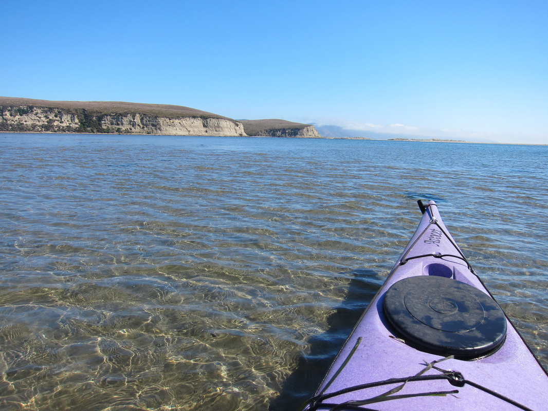
Taking a lunch break on the sand bar at the mouth of the estero.
| According to this writeup by the USGS, the unique shape of Point Reyes, which extends approximately 15 km out from the coast, often made it too difficult for ships to sail far enough west to get around the point. Ships often ended up shipwrecked and stranded in Drakes Bay. Before the 120 meters of sea level rise that occurred over the last 18,000 years (woah), Drakes Estero was just a river valley, which is why it has such a unique shape. It's sometimes said that it looks like a hand, with Limantour Estero to the east as the thumb (see map below). Today the freshwater inflows from the minor creeks are very small compared to the tides and currents flushing the Estero twice-daily. The sand barrier (Limantour Spit) that builds up in front of the Estero is created because the prevailing sediment transport moves from south to north along the coast. Since most of the waves reaching California come from the Pacific Northwest, the waves bend around Point Reyes and end up reaching the beach from the south (kind of counter-intuitive), eroding the sandy cliffs from the south end of Drakes bay. The waves push the eroded sand up along Drakes Bay, where it ends up on the beach. Phew, ok enough nerding out... Date: Sunday, October 7, 2012 Time: 4 hours Distance: ~9 miles | 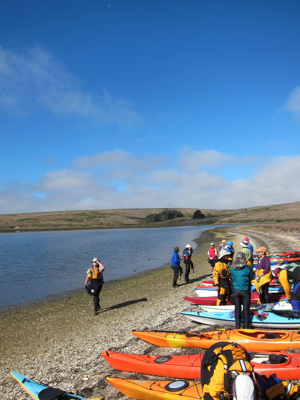 Big group of BASK paddlers at the launch site. |
 RSS Feed

