 Dilapidated buildings, west shore of Point San Pablo. | After our nature-drenched paddle on Saturday, Jeff and I stayed close to Berkeley and checked out the developed shoreline of Richmond in San Francisco Bay. After kayak polo we loaded ourselves + our wet butts into Tess (my blue Subaru) and drove 15 minutes up I-80 to Miller Knox Regional Shoreline. Some of my colleagues are working on a project to restore a pond in the park, so we went for a brief stroll around the pond to take photos. The pond used to be a coastal lagoon/inlet before a railroad was built along the entire shoreline, cutting off connection with the Bay and converting the tidal lagoon to a scummy pond. After the stroll, we parked at Keller Beach, just north of Miller Knox, to launch our boats. A park attendant pulled over in his truck to inform us that we were launching in a very inconvenient location. Rather than take his advice to launch further south, we stubbornly carried our boats down and up the large hill, including multiple flights of stairs. We do this partly for exercise, right? |
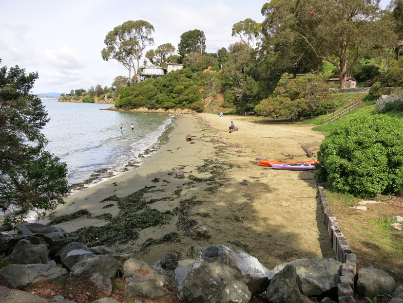
Keller Beach, the launch site. Warning: you'll have to carry your boat up and down a hill if you decide to launch here...
Armored shoreline railroad running along the front of Miller Knox Regional Shoreline.
We launched from the seaweed-covered beach and paddled north towards the Chevron Pier. In my mileage estimates the night before I assumed that we could paddle through/under the many piers extending from the Richmond shoreline. Alas, Chevron does not allow us to paddle underneath its 48" diameter oil pipeline, so we added a mile (and some stress) to our trip by detouring around the parked oil tankers at the end of the pier. Multiple signs warned us to stay 300 yards away from the pier.
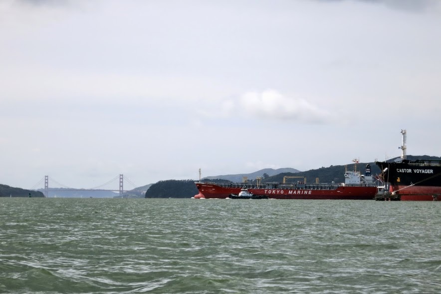
A barge passing a parked oil tanker. Golden Gate Bridge and Angel Island in the background.
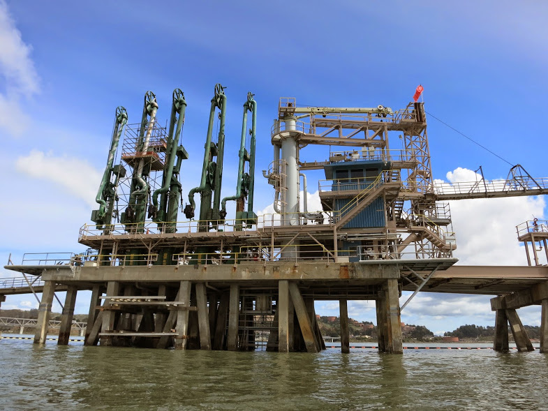
Some machinery at the end of the Chevron Pier.
Jeff checking out the oil tanker and miscellaneous equipment.
We eventually made it past the pier (which extends ~1 mile into the Bay) and under the Richmond Bridge. Since you can't paddle anywhere in California without seeing seals, we ran into (not literally) some seals propped up on Castro Rocks, underneath the bridge.
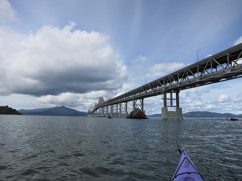
Under the Richmond Bridge. You can't see it here, but we were greeted by a number of ornery seals who were basking on Castro Rocks. To the left of the photo is Red Rock Island, where I paddled a week earlier.
We stuck fairly close to shore on our way north, exploring a number of historic sites along the way, the first of which was this castle between Point Molate and Point Orient:
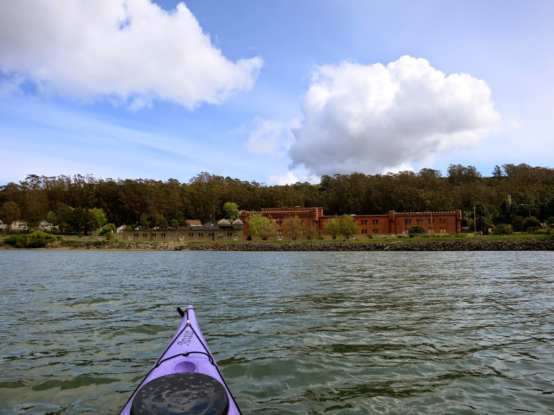
Point Molate Naval Fuel Depot (decommissioned)
| The castle was originally constructed as part of a winery - the largest winery in the U.S. prior to prohibition. During Prohibition the winery tried to survive on grape juice, but eventually had to shut down, along with a number of other industries along the Point Richmond shoreline. Subsequently, it opened as the Point Molate Naval Fuel Depot in 1941, and later closed in 1998. Point Molate Beach was opened to the public last October (2013) for the first time in 10 years. Currently there are major efforts to convert the castle into a casino, which would be very sad, indeed. | 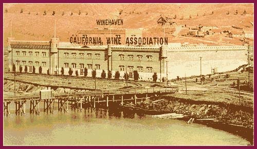 The castle in its heyday as a winery. Photo from http://www.pointrichmond.com/pointsanpablo/history.htm |
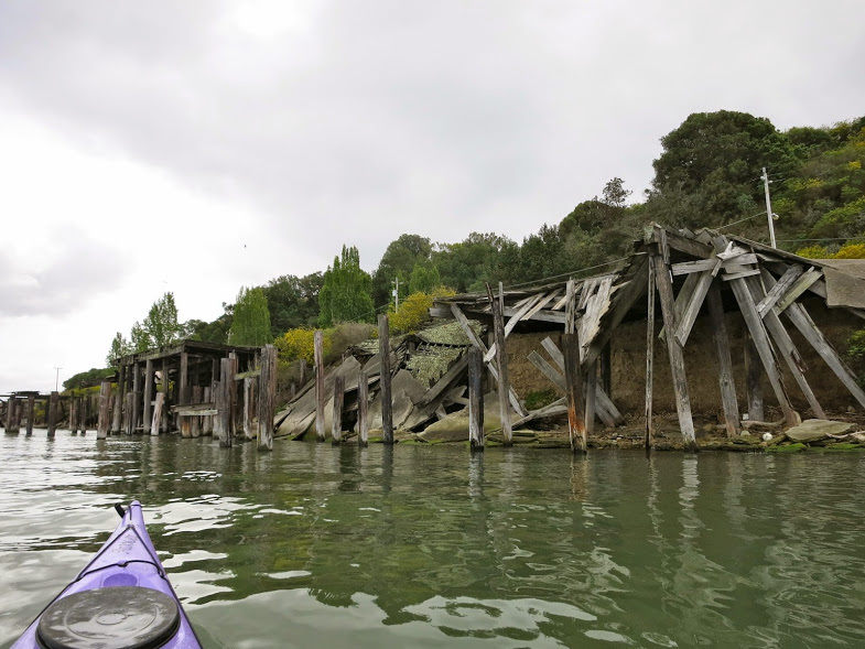
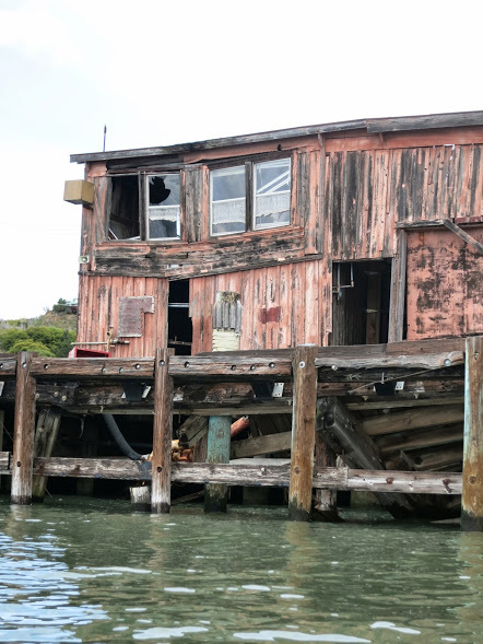
More piers that have collapsed into the bay, leaving behind creosote piles that take ages to degrade.
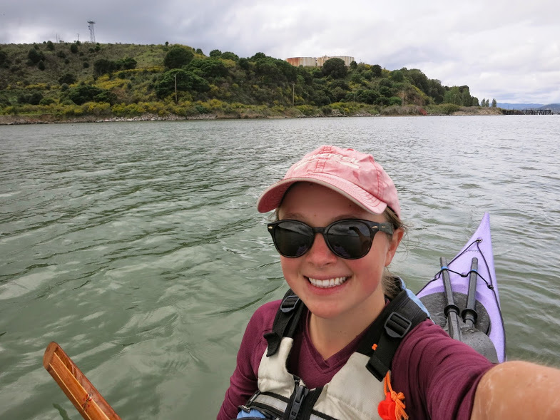
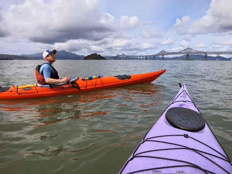
Apologies for all the kayaking selfies recently. This is the easiest way to deal with having one camera in the group. Also note extensive salt stains on my arm...
As we rounded Point San Pablo, the main Chevron Oil Refinery came into sight:
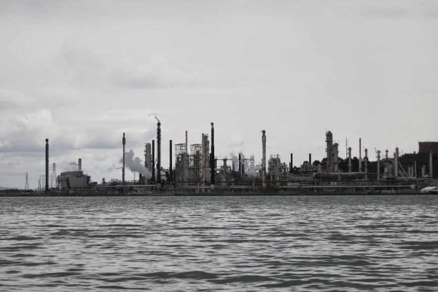
The Chevron Oil Refinery: site of a major fire on August 6th 2012 that sent 15,000 people seeking treatment at local hospitals.
We had lunch nearby on a rebar-filled breakwater protecting a landfill (glamorous). This spot is pretty exposed, so strong winds kept us from a leisurely lunch. Lacking enough vegetables, we finished the hummus with a spoon and were on our way. The afternoon waves tend to pick up in SF Bay, and Sunday was no exception. We paddled hard into the wind until we again rounded Point San Pablo. Across from the Point are two islands (The Brothers), where a lighthouse constructed in 1853 still stands and is also managed as a bed and breakfast.
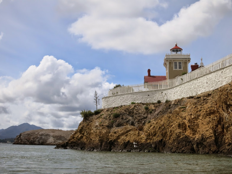
East Brother Light Station on Brothers Island: Built in 1853, the lighthouse is still maintained and run as a Bed and Breakfast. Reservations start at $315/night!
The return trip was uneventful - I sang bad pop songs to keep up morale (or maybe kill it?). When we rounded the Chevron Pier, the waves had picked up and we tried to surf our way back into shore. We sadly loaded up our boats after the last paddle of our bingeyaking weekend and commenced post-kayaking-logistics-madness, which I won't bore you with but involves a couple hours of driving and washing and drying and showering.
Date: Sunday, March 30th, 2014
Duration: ~ 4 hours?
Distance: ~ 15 miles
Date: Sunday, March 30th, 2014
Duration: ~ 4 hours?
Distance: ~ 15 miles
 RSS Feed

