
Approaching Hog Island at dusk. Photo © 2013 Joël Thai
Today I'm digging into the archives to recount my first true overnight kayak camping trip in California (sad, I know). Beth, Sara, Eddie, Joel, Christina, Brian, Alice, and I camped overnight at Tomales Beach in Tomales Bay. Dane + 2 friends joined us for the Saturday paddle and lunch.
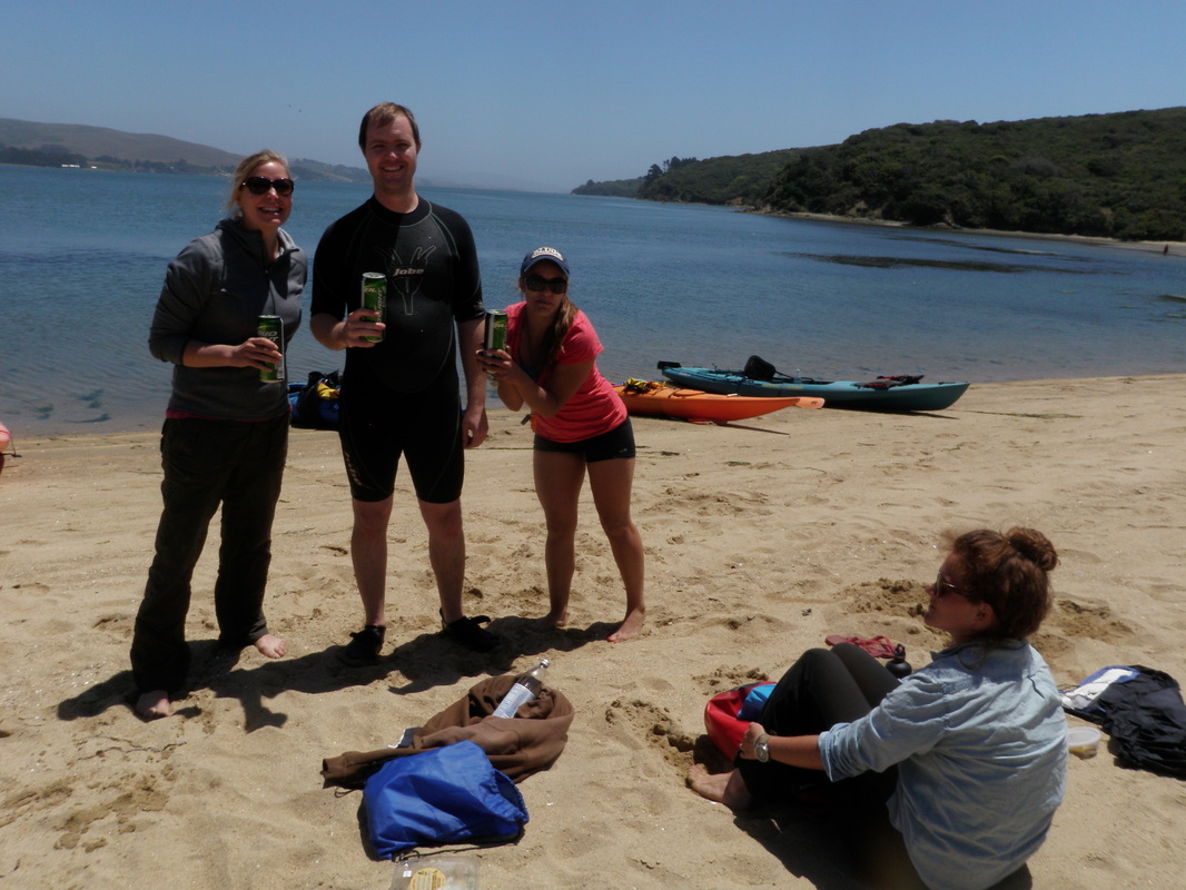
Sponsored by Bud Light Lime.
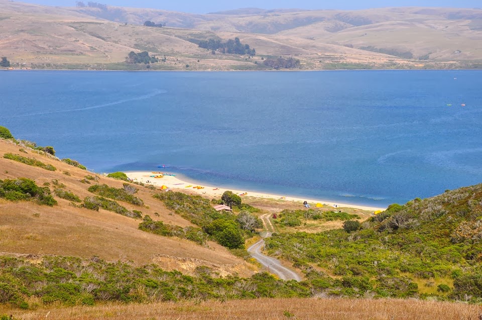
A few of us hiked up the access road for some wonderful views of the Bay.
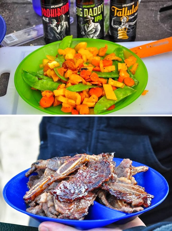 Dinner of sauteed veggies and short ribs. Photo © 2013 Joël Thai | After a delicious dinner of sauteed veggies and Korean short ribs (great suggestion by Christina), a group of us embarked on a sunset paddle. We promised Christina and Brian that we'd be back in an hour and headed north. It was a cool evening, but the breeze had calmed down (Tomales Bay tends to be very windy in the afternoons). We set our sights on Hog Island, about 1.8 miles north of Tomales Beach. Along the way, Eddie (fellow hydrologist) and I noticed a drop in the water surface and a narrow band of turbulence spanning the Bay. We decided that this was caused by a slight narrowing of the Bay and the outgoing tide. This USGS map shows that this spot, known as Pelican Point, is about 30 meters deeper than the surrounding areas. 30 minutes later we were still quite far from Hog Island, and dusk was setting in. After a long discussion we decided to continue on, magnetized by the eerie island in the distance. Upon closer inspection, the trees were densely populated by a colony of cormorants and painted white with a thick layer of bird poop. With darkness setting in, the rustling birds and sparse vegetation made the island feel quite spooky. |
Camp on Tomales Beach
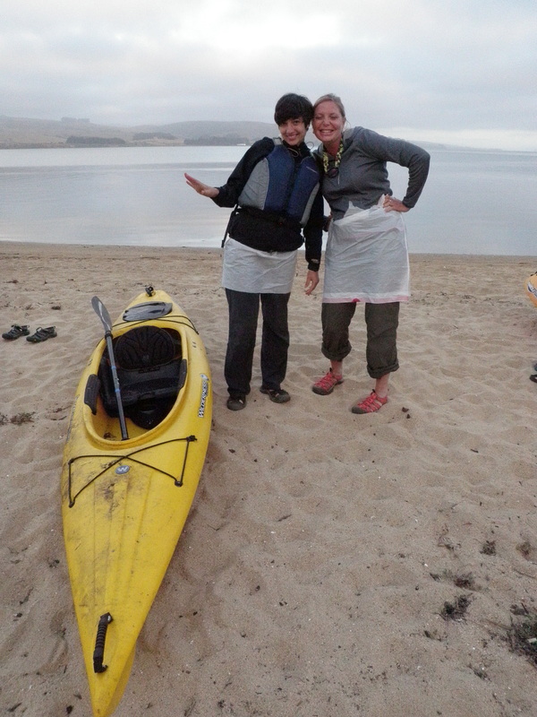 Beth and Sara with their "waterproof" skirts. | 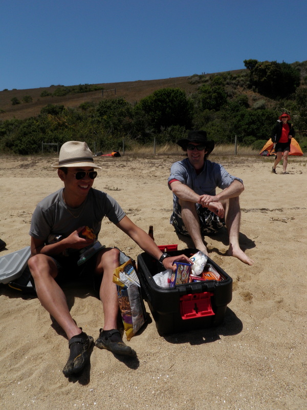 Joel and Eddie sharing their fantastic picnic feast. |
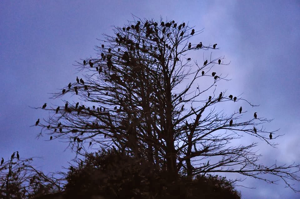
Cormorants in the tree on Hog Island. Photo © 2013 Joël Thai. Did you know that Hog Island was purchased for $800 in 1906 when the previous owner went bankrupt? What a steal for 2 acres!
Water Nerding! Bioluminescence in Tomales Bay
As we paddled back, I gradually became aware of my paddle moving through the water with each stroke. At first I assumed this was my anticipation of returning to the beach, where a warm fire was awaiting us. However, I couldn't seem to take my eyes off my paddle blades, and soon realized that I was experiencing a special Tomales Bay phenomenon: bioluminescence, the production of light by living organisms. In Tomales Bay these organisms are called "dinoflagellates". They are most prolific during late summer and early fall when strong winds cause upwellings (when deep, cold, nutrient-rich water swirls up to the surface). They gather the sun's energy during the day and glow when jostled. This is thought to be a defense mechanism. When I pointed this out to my fellow paddlers, they were skeptical at first. Darkness hadn't set in entirely, and the glow was still very faint. The dinoflagellates tend to cluster in eelgrass beds, which are abundant in the shallower parts of the Bay. When we reached a patch of eelgrass, the water around us began to sparkle with bright green light, and the splashing began! We excitedly returned to the campsite and encouraged other reluctant campers to get back into their cold, damp, kayaks to make their own watery fireworks. It was harder to see the glow from the beach, where headlamps and campfires overpowered the glow. However, simply walking in the wet sand left glowing footprints behind! We stayed in our boats as long as possible, splashing and trying to take pictures of the magical glow until the cold drove us to the brighter campfire.
On trip to Point Reyes two weeks later, many of us saw the bioluminescence in another form. As we stood on the beach at Coast Camp (on the west side of the peninsula), flashes of green light lit up the shoreline with each crashing wave.
On trip to Point Reyes two weeks later, many of us saw the bioluminescence in another form. As we stood on the beach at Coast Camp (on the west side of the peninsula), flashes of green light lit up the shoreline with each crashing wave.
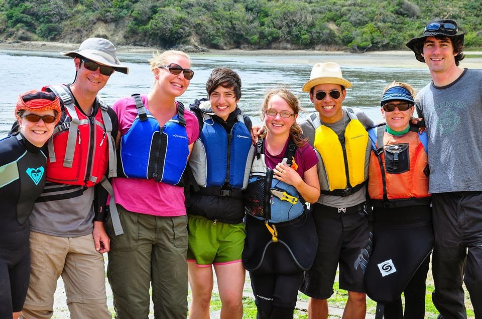
The overnight crew! From left to right: Christina, Brian, Sara, Beth, Nena, Joël, Alice, and Eddie. Photo © 2013 Joël Thai
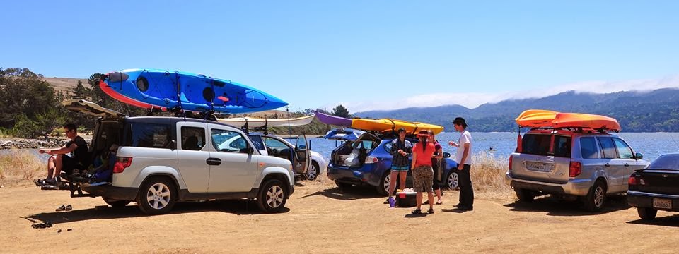
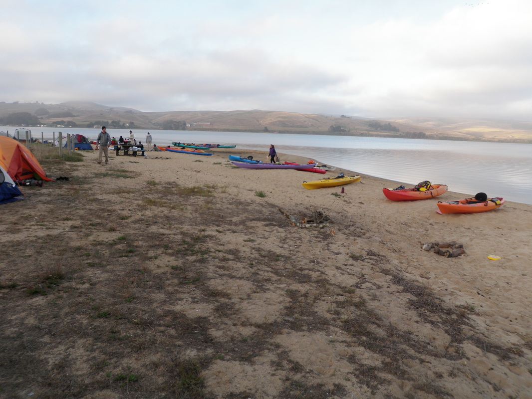
Boats loaded up and ready to go home. Photo © 2013 Joël Thai
Date: Saturday/Sunday August 13-14th, 2013
Time: 2 days!
Distance ~ 11 miles (very rough)
Time: 2 days!
Distance ~ 11 miles (very rough)
 RSS Feed

