First break, sitting on a log.
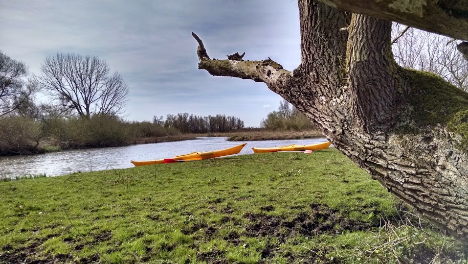
The Biesbosch is a national park in the Netherlands, located about 30 minutes (drive) southeast of Rotterdam. On Sunday, Henk Jan and I hopped in the Beast (his 400k mile Volvo) and drove down to the Biesbosch for a day of kayaking. The Biesbosch is best explored by boat, since it consists of endless channels that weave around low-lying islands. The Biesbosch has a long history of inhabitants and water management. I'll tell you about that at the end of this post. We spent about 5 hours paddling through the channels, ending up with a solid 11-mile paddle for Henk Jan's first time in a kayak...
Kayak rentals are available at two access points to the Biesbosch: across the Maas River in the town of Drimmelen and also from the east in the town of Hank. We departed from Hank so we wouldn't have to cross the busy Maas River. The kayak rental process was easy at Natuurpoort De Biesbosch - Vissershang. Past the racks of plastic canoes and kayaks stands a small green hut. There, we filled out a simple form, paid 17 euros per single kayak, and were set to go. Since we're in the Netherlands, no PFD was included in the rental. It's only recommended if you don't know how to swim...
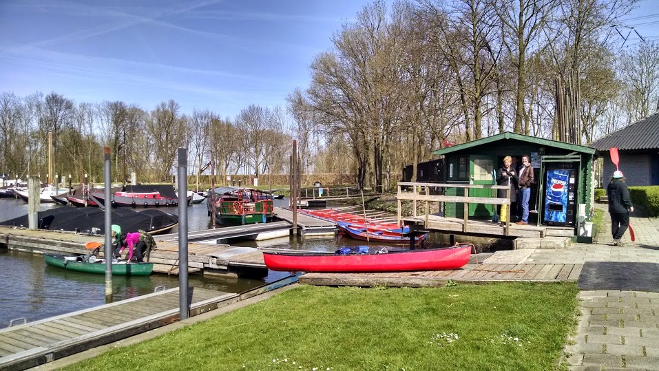
The little rental shed. A group of canoers were coming back from an overnight trip in the Biesbosch.
The kayaks were only available in one size: small, but 6'4" Henk Jan managed just fine with his feet on the farthest-most foot-pegs. The paddles were heavy and the aluminum shaft turned both of our hands a shiny dark grey by the end of the day. I was a disappointed when the cockpit was slightly larger than my sprayskirt would stretch. However, it turned out to be a sunny warm day, so a bit of water on the lap was no big deal. We crammed our Dutch lunch behind the seat (no hatches in these babies), took a quick look at the complicated map, and were off! Unsure whether we would complete the 18-km loop, we headed south/west first to start with the most interesting portion.
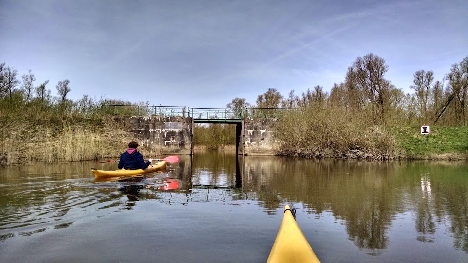
Approaching Brug van Sint Jan (Saint Jan's Bridge)
The waterway narrows quickly after turning right off the Spijkerboor into the Sloot van Sint Jan (St. Jan's Canal). It weaves back and forth between low-lying islands covered in willows. Strangely, for most of the trip, we found ourselves paddling with a dike in sight. From the map (see Google map below), it seems like there are ponds that are diked off from the rest of the wetland. I imagine this may be for flood management purposes (e.g. pump water into these areas during a flood), but I'm not sure... [Update! These are drinking water reservoirs.]
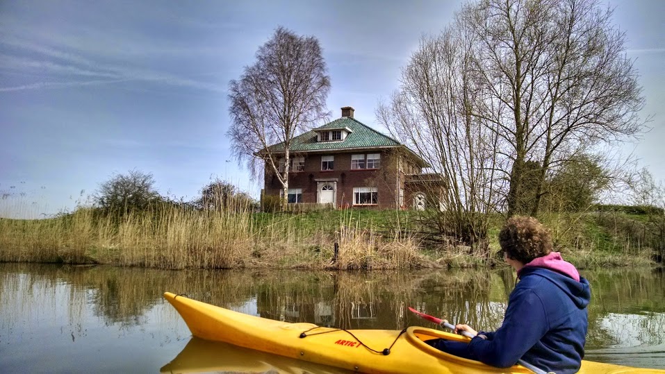
Amaliahoeve - one of the farms that still exist in the Biesbosch. We were admiring the nice (and rare) green tiled roof on this house.
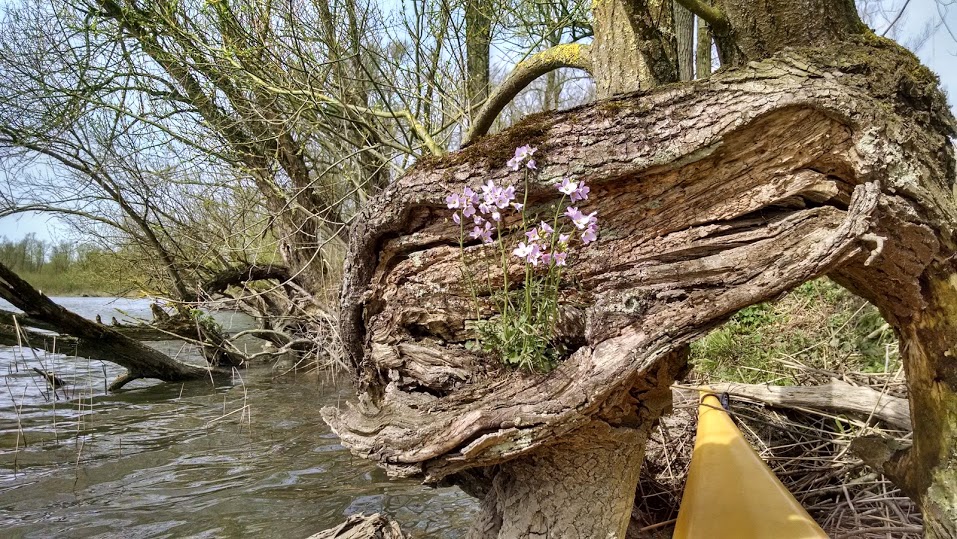
Spring flowers growing in an old tree trunk.
 This plant and I became good friends throughout the day. Ow!
After a few hours, we pulled off to the side of the Ruigt for lunch. We tentatively made our way through the trees and nettles (ow!) until we reached a low-lying but sunny/dry dike. From our perch, we watched leisure and tour boats pass on the Ruigt.
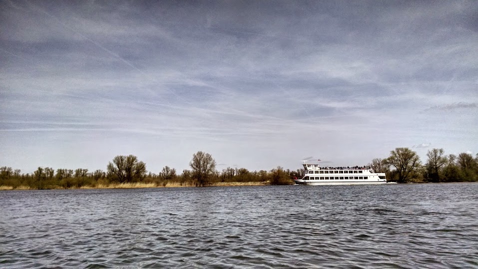
Big tourist boat making its way down the Ruigt.
We made good time after lunch - must have been all that Dutch lunch energy. The wind was expected to pick up in the afternoon, so we anticipated a tough paddle back along the Steurgat channel. Luckily, there was a narrow side channel for non-motorized boats along the west side. We made it back to the dock by 3:30pm.
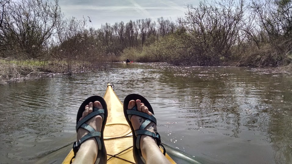
First signs of exhaustion setting in: feet go up on the deck. Henk Jan is kicking my butt at this point.
The water nerd part...
The Biesbosch has a long and complicated history with human intervention and environmental changes. Hundreds of years ago, it was inhabited by small villages and agricultural land. In 1421, the St. Elizabeth flood submerged 300 square kilometers of this land, most of which gradually converted (back!) to a network of tidal estuaries. [What I find entertaining is that many of the articles I've read describe the "creation of the Biesbosch," as if humans and their development were the first to exist, and then this natural area was suddenly created...] In the centuries since the St. Elizabeth flood, much of the Biesbosch was reclaimed and poldered once again. The list of man-made changes to the hydrology is lengthy and complicated (diverting rivers, new channels, closing off creeks). Little remains of the origin system. The closing off of creeks on the upstream end and the construction of the Haringvliet Dam (which blocks the Haringvliet estuary from the North Sea) cut off almost all freshwater, saltwater, and tidal influence to the Biesbosch. Today most of the wetlands only receive water during times of high discharge (e.g. storms). Because of these changes, the Biesbosch is now converted into a somewhat stagnant freshwater willow forest. Today, there are some efforts to restore aspects of the Biesbosch. Apparently they're thinking about reintroducing moose to the Biesbosch?
A few lasts comment on history... During World War II the Biesbosch was used by the Dutch to escape from the Germans. The vast network of narrow canals and soggy, difficult-to-access land made it the perfect hiding spot. Also, 5 beavers were successfully reintroduced to the Biesbosch in 1988 (apparently the last native beaver was clubbed to death in 1825). Today there are over 60 beaver dams in the Biesbosch.
A few lasts comment on history... During World War II the Biesbosch was used by the Dutch to escape from the Germans. The vast network of narrow canals and soggy, difficult-to-access land made it the perfect hiding spot. Also, 5 beavers were successfully reintroduced to the Biesbosch in 1988 (apparently the last native beaver was clubbed to death in 1825). Today there are over 60 beaver dams in the Biesbosch.
Date: Sunday April 12, 2015
Distance: 17.7 km (11 miles)
Duration: ~6 hours, including 1 of breaks
Weather: Sunny, windy, ~10 - 14 C
Distance: 17.7 km (11 miles)
Duration: ~6 hours, including 1 of breaks
Weather: Sunny, windy, ~10 - 14 C
 RSS Feed

