View of the wetlands from the viewing tower in the dunes.
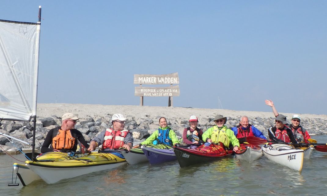
On April 7th, 2019, the first kayakers of 2019 set foot on the Marker Wadden islands. The islands are nestled in the northeast corner of Markermeer, a large manmade lake east of Amsterdam.
The Markermeer was born in 1976 when a larger lake (Ijsselmeer, also manmade) was divided by a long east-west dike. The plan was to drain the lake and create more agricultural land, to feed the rapidly growing Dutch population. By the time the dike was completed in 1976, twenty years had passed, and politics and public opinions were evolving. Though the population was still growing rapidly, concerns about food supply were alleviated thanks to increased international trade and more efficient agricultural techniques. The Markermeer was becoming popular with bird populations and water sports enthusiasts. Moreover, the project could not be justified from a financial perspective. The plan to drain the lake was dead.
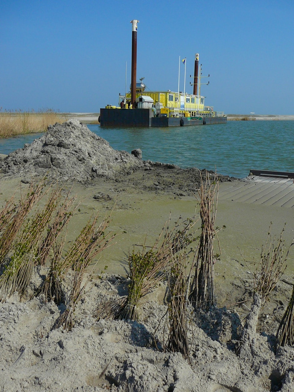
A barge with offices for construction workers, near the boat ramp (photo: Eric M.)
|
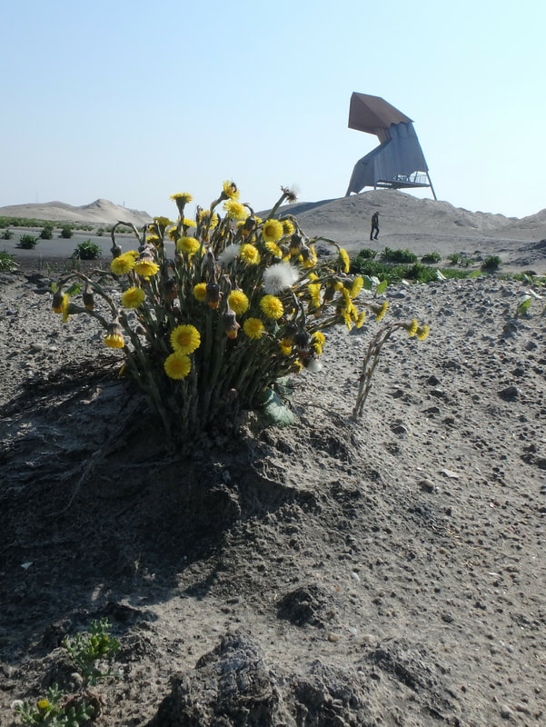
One of a few plants we saw all over the island, with the lookout tower in the background (photo: Marianne)
|
The Markermeer remains today but is not without problems. Given its limited connectivity to other rivers and lakes, it suffers from poor water quality. In 2012, Natuurmonumenten (a Dutch organization that buys, protects and manages nature reserves in the Netherlands, not unlike The Nature Conservancy), proposed developing a nature reserve in the lake, and the idea for the Marker Wadden islands was born. The goal was to build an archipelago of five new islands. The islands would provide unique habitats for fish, birds, and other wildlife, generate recreational opportunities, and improve water quality.
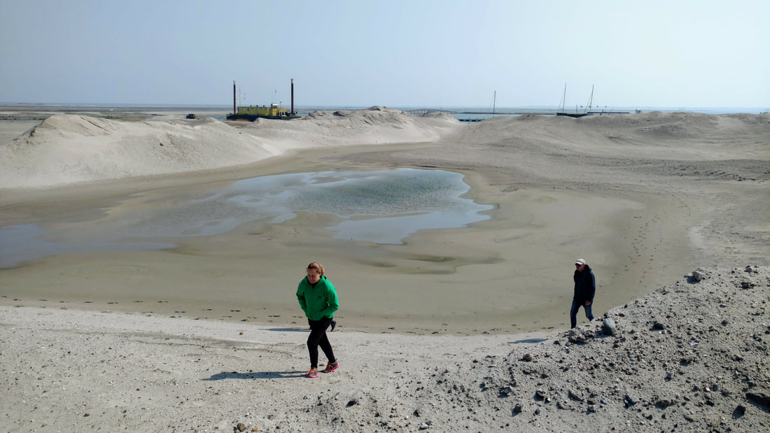
Elsbeth and Berend traversing a sand dune to reach the lookout tower, the harbor in the distance.
Construction of the Marker Wadden began in 2016 and continues today. In September 2018, the first of the islands was opened to the public. It is only accessible by boat, and the first ferries will run on April 20th this year! Here's the most recent time lapse video I could find of the islands, which stops in 2017. I'll update when I find a more recent one! Even the Google Maps image is quite old...
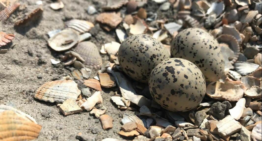
Three small eggs in an abandoned "nest" on the trail (photo: Marianne)
It's a unique experience to visit a place as "remote" as the Marker Wadden in the densely developed Netherlands. Without easy public access, you (currently) need your own boat to reach the islands. Luckily, as kayakers, we are equipped with small sea-going vessels perfectly suited to the 10 km paddle from the mainland!
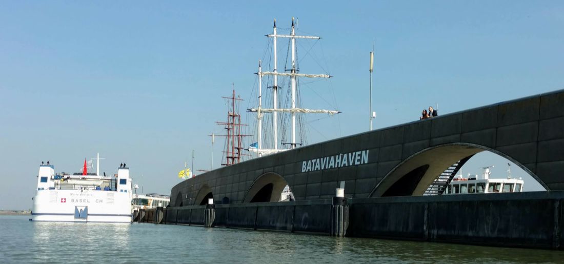
Entrance to Bataviahaven, the harbor in Lelystad.
On Sunday, April 7th, 2019, nine Never Dry kayakers (Nena, Henk, Berend, Iede, Elsbeth, Mike, Eric, Marianne, and Erik) convened in Bataviahaven in the city of Lelystad. It was easy to access the boat launch. We drove our cars close to the put-in and unloaded the boats, before parking in a nearby garage. The adjacent shopping center opens at 10am, so the harbor was quiet.
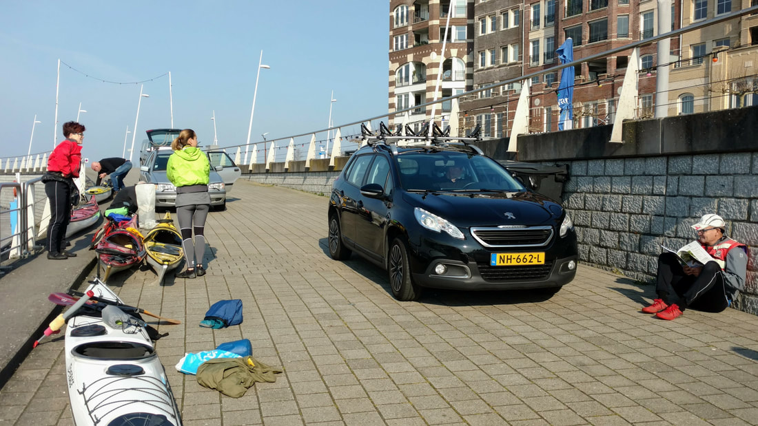
Unloading the boats. We could drive the cars right up to the edge of the seawall.
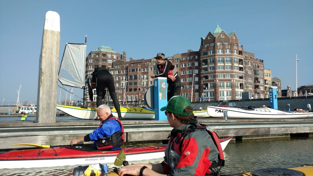
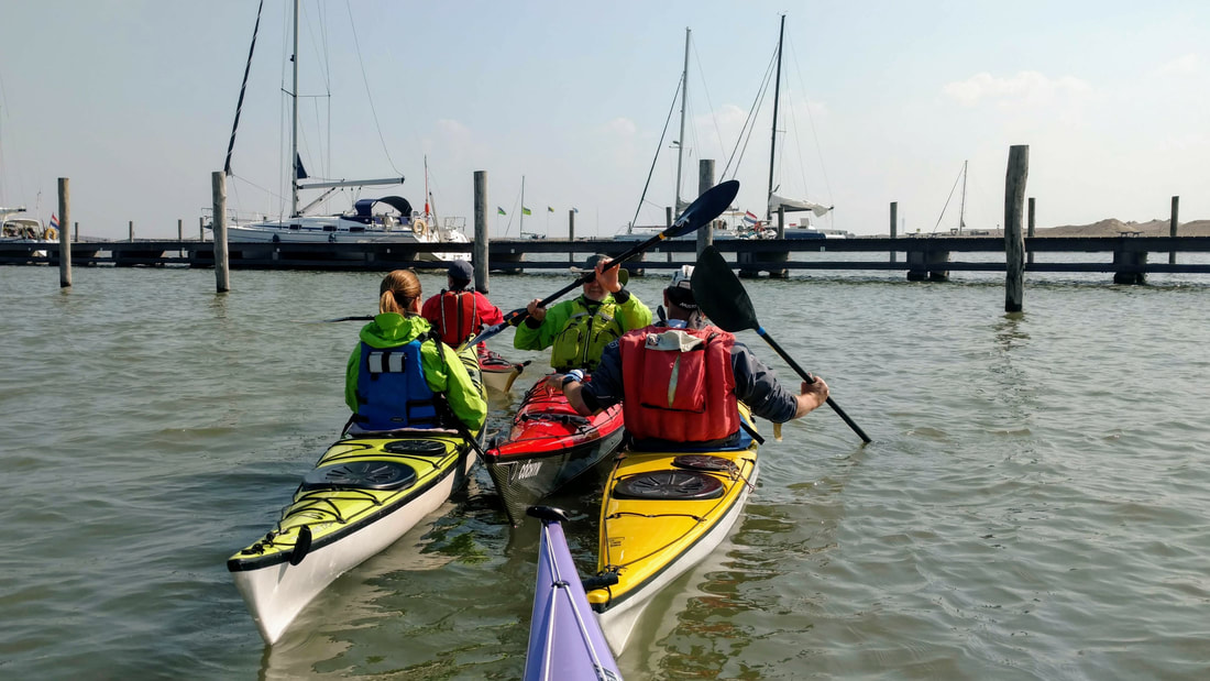
Launching from the docks. Berend setting up his sail and Iede eating a sandwich.
It was an unusually beautiful day, with warm temperatures (20C) and light winds from the northeast. We paddled out of Bataviahaven and made our way up the coast. The first stretch was noisy and unpleasant. A highway runs along the top of a rocky dike next to the lake. A few kilometers later, we spotted the buoy line surrounding the islands and began the 3 km crossing.
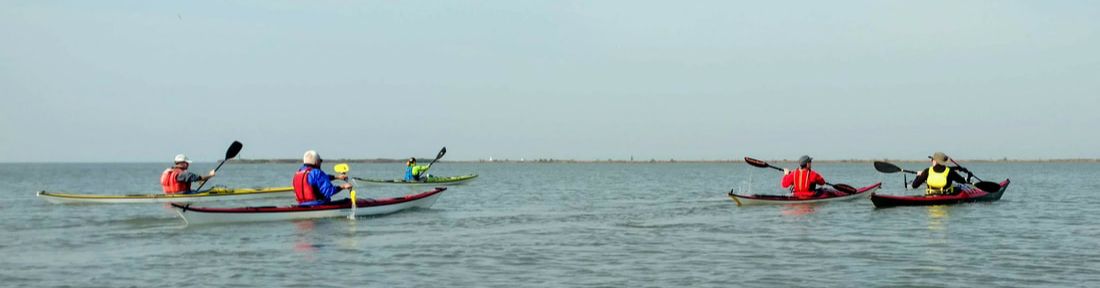
Off we go! From left to right: Erik, Eric, Elsbeth, Marianne, and Mike.
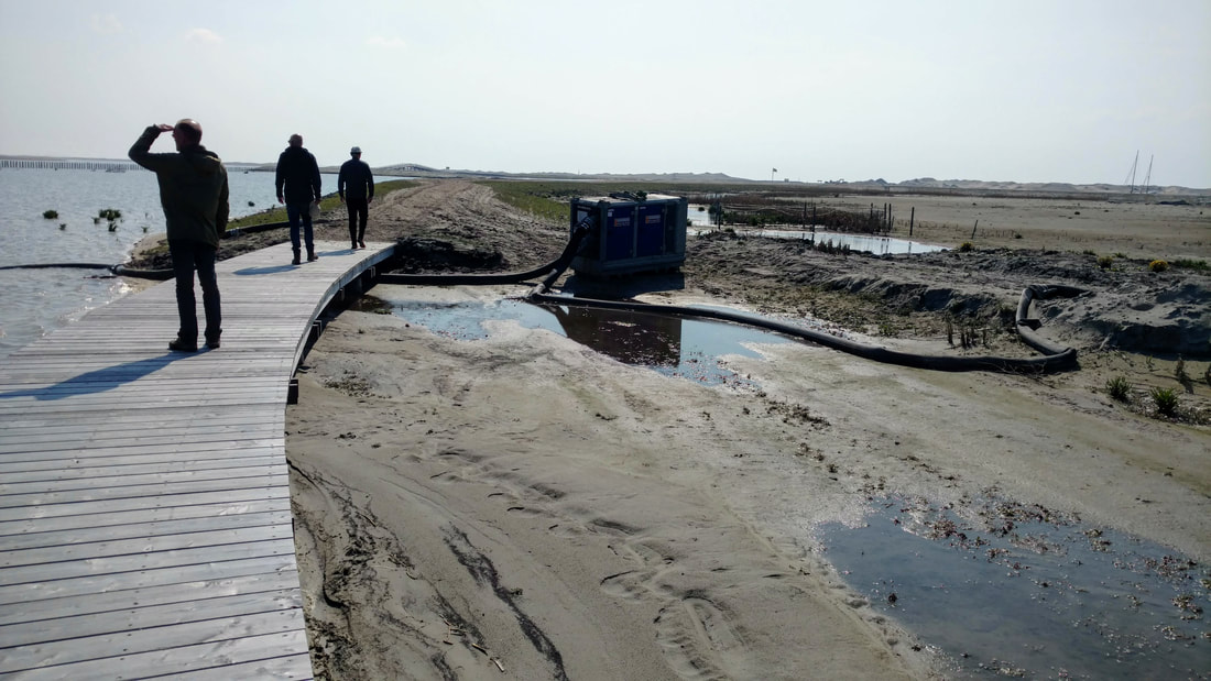
As we approached the island, we noticed a few large ships, barges, and platforms stationed along the shore. Construction is still in progress on the east end of the islands.
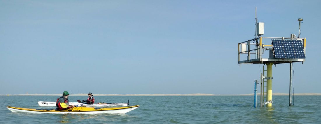
Henk and Iede checking out a monitoring station near the entrance to the Marker Wadden harbor.
The buoys were topped with red and white markers, prohibiting us from paddling closer to the islands. We followed the buoys to the harbor, as the sunny sandy beaches beckoned to us from across the no trespassing zone.
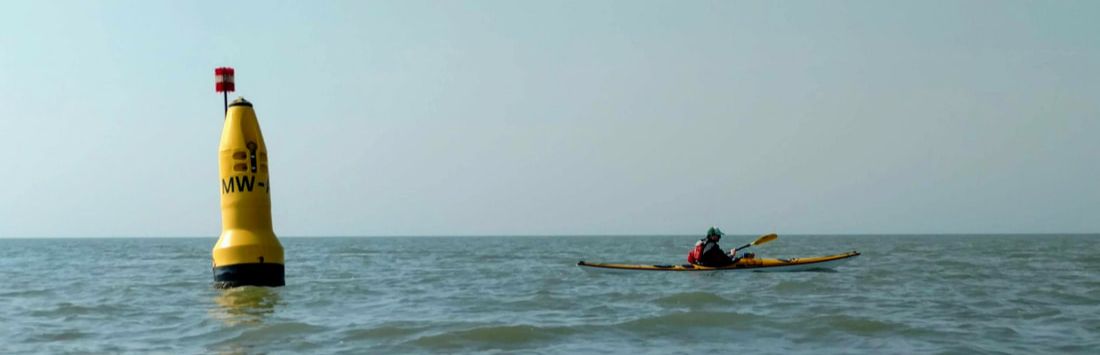
Henk and one of the many yellow Marker Wadden buoys we followed. The red and white marker indicates a no crossing zone.
We passed ~11 buoys before arriving at the small harbor entrance. Some sparse sailboat masts protruded from behind the breakwater. Past the sailboats, we found a small beach and ramp for smaller boats (none of this is visible on Google Maps yet). We landed our boats and took our first steps on the new island, which we later learned were the first kayaker steps of 2019!
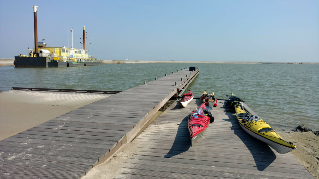
The ramp for small boats arriving to the island.
An ongoing theme of the trip was the "Blue Water App," a mobile app allowing visitors to pay the small visitor fee (6 euros). Plenty of debate ensued about how to use this app as a kayaker. We never figured it out. This was not for lack of trying! Instead, we arrived armed with old fashioned cash to bribe rangers, if needed. Contrary to expectations, we met two extremely friendly rangers who promptly pulled handed us a small debit card machine. This should not have been a surprise, given that the Netherlands hates cash.
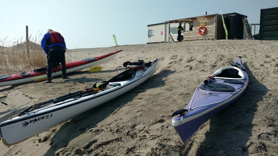
Boats on the beach and the temporary ranger station and composting toilet in the distance.
A loud generator was running near the boat ramp. It provided power to a small temporary shelter containing an office, sleeping quarters, and a composting toilet. Two park rangers are always present on the island, working in 1-week shifts. The rangers had arrived recently and were very excited about their new jobs. Their enthusiasm was contagious!
The first order of business was, naturally, lunch. We hunkered down behind the shelter, protected from the wind but basked in the sun.
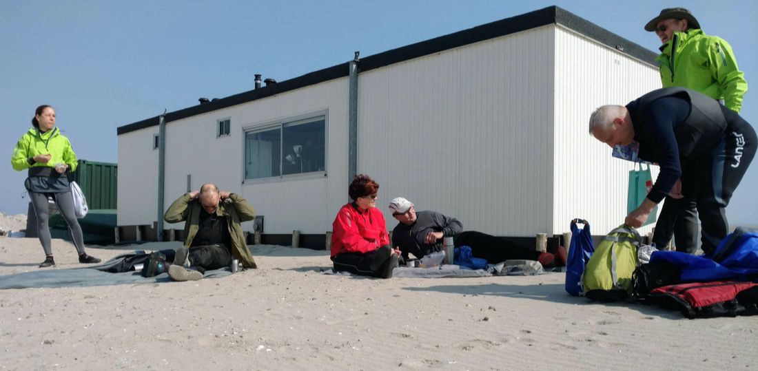
Setting up for lunch in the sheltered area behind the ranger station.
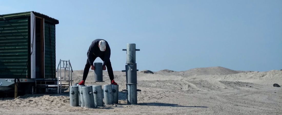
Erik was bored while waiting, so he started stacking things...
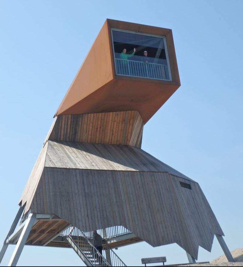
Elsbeth and Nena in the lookout tower (photo: Marianne)
|
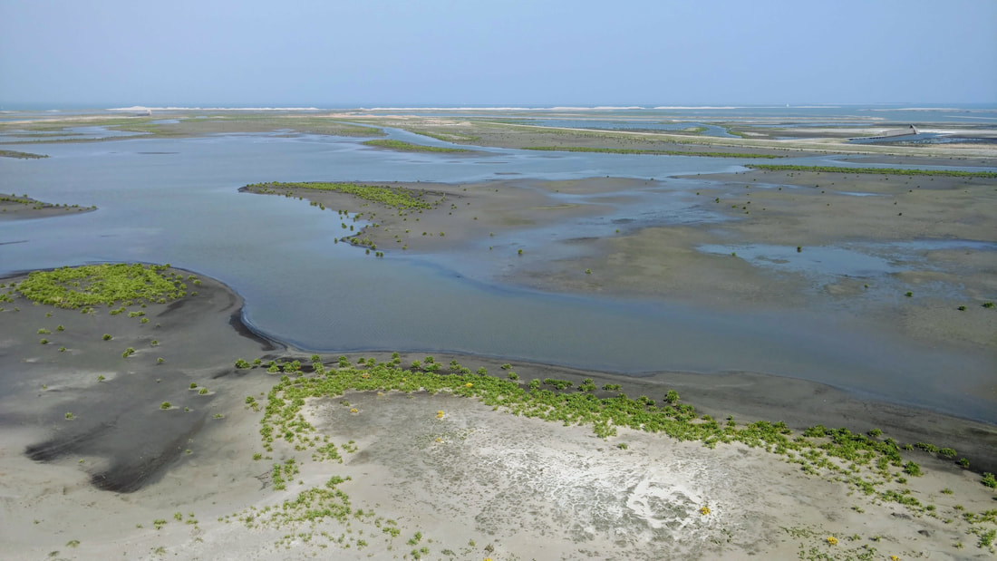
After lunch, everyone except Mike went for a walk on one of the new trails. We traversed the high coastal sand dunes to a lookout tower. The southwest face of the islands is lined with high, wide sand dunes, which protect the island from southerly storms. The north side of the island is sheltered by the dike. The island is a mass experiment. There are many scientific studies happening within the Marker Wadden. One study is assessing various types of fine sediment for use in (is)land construction (shout out to Maria!). According to the "forest rangers," the island was constructed almost entirely with material sourced in the Markermeer. This collected some of the fine sediment trapped in the lake, which is a main cause of the water quality issues. Another challenge is to create a vibrant wetland in a lake with no tides. I am not so familiar with Dutch wetland species, especially not in freshwater, but I did not recognize many of the pioneering wetland plants on the island.
|
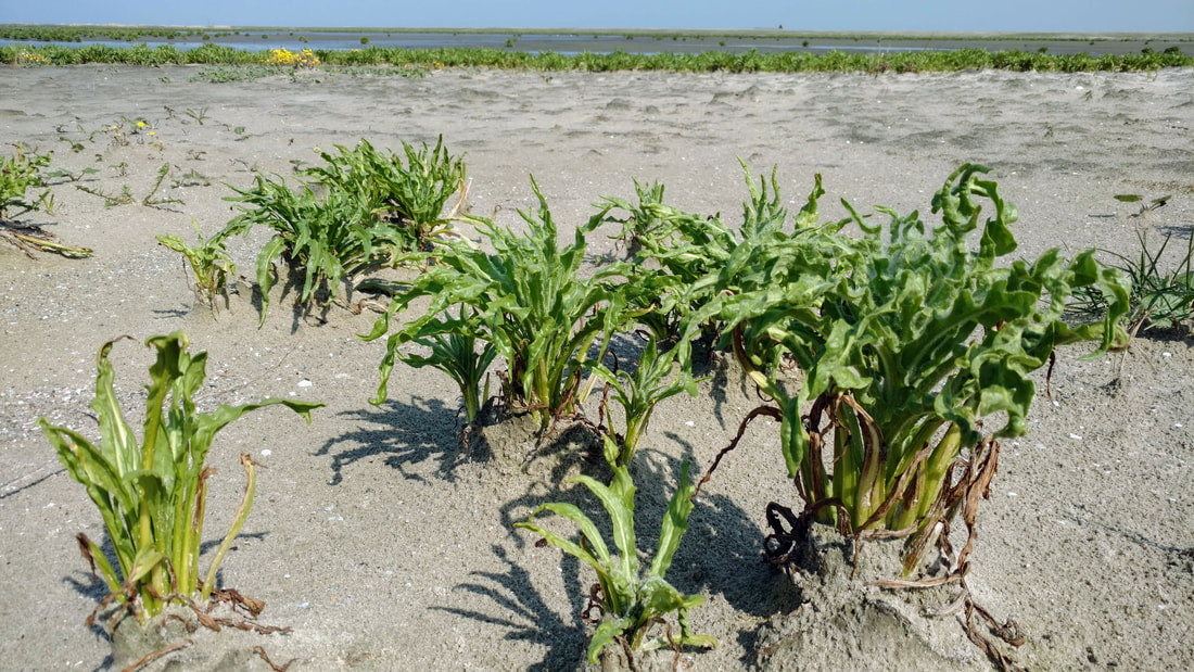
These plants were everywhere on the low-lying parts of the island. Do you know what they are? Is this a native wetland species or an opportunistic weed?
During our walk, it was apparent that the islands are still at a very early stage of development. There were pumps, construction vehicles, generators, and poor drainages at various locations along the trail. Vegetation was sparse, but clearly growing and spreading. We spotted a number of birds, some of which, according to Marianne, are rare! I am curious how it will look in a few years, once construction is complete and nature has more fully moved in. A small campground will open on the island later this summer. Never Dry will return next year to see how things have developed!
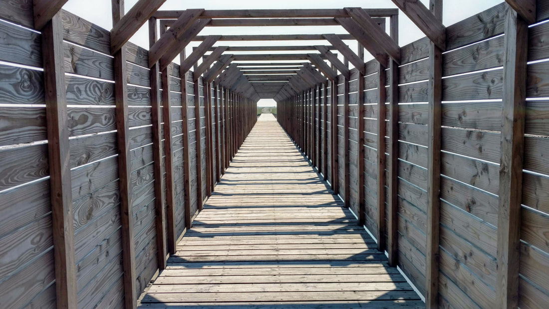
Section of boardwalk on the trail, with a pump connecting two parts of the wetland.
Entrance to one of the bird watching huts.
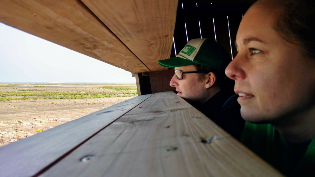
Henk and Elsbeth watching birds!
The Marker Wadden islands are a perfect example of highly engineered Dutch nature. It's a step in the right direction to address the destruction of the natural estuary in the early 20th century. It's clear that the islands will become a valuable asset for both nature and recreation. It would never exist without human interference and will require ongoing maintenance in the future. But the birds, insects, fish, sailors, park rangers, dredging companies, and kayakers seem to be happy!
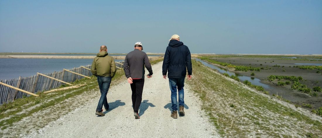
It's a rare known fact that Never Dry members also have legs and can move on land! Iede, Erik, and Berend walking along the trail.
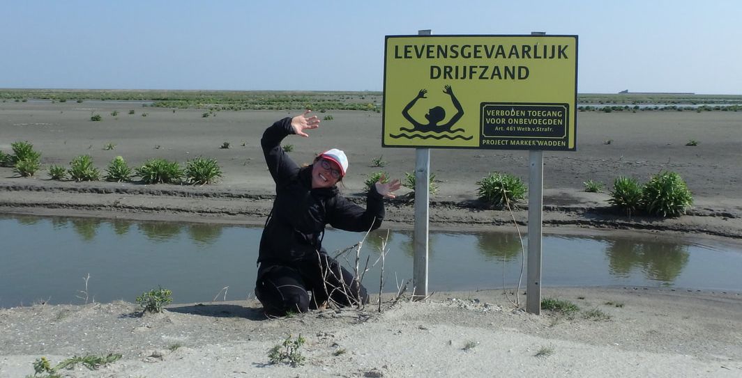
"Deadly quicksand!" I did not sink... (photo: Erik)
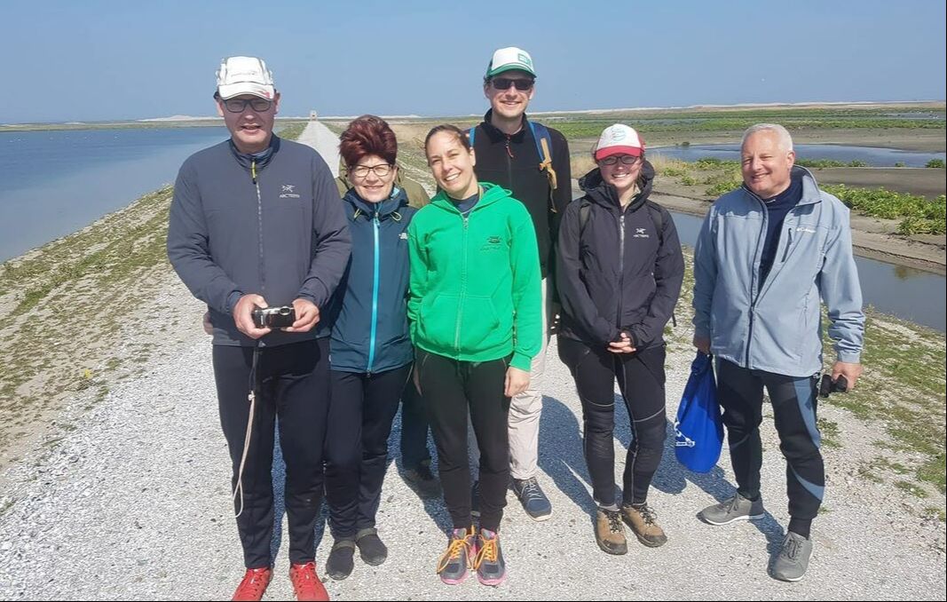
Awkward group shot! Erik, Marianne, Elsbeth, Henk, Nena, and Eric. (photo: Berend)
The paddle back was smooth. We followed a similar route but made a more diagonal crossing back to Lelystad to avoid the highway. Back in Bataviahaven, we tested the boat ramp. This was also an easy spot to get in and out of our boats, but we had to carry our boats a bit further to reach the cars.
Un-rafting prior to departure.
A successful group shot, thanks to Marianne!
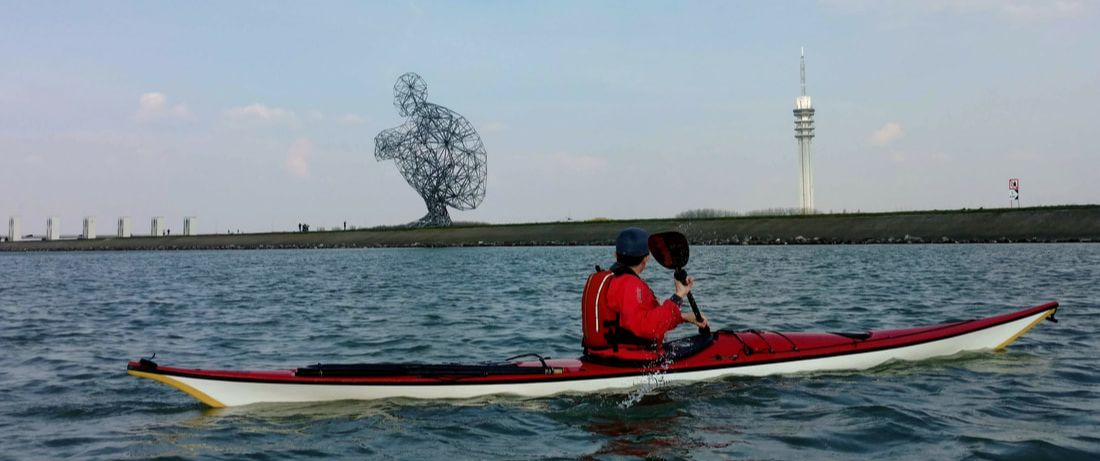
The squatting man on the dike, who welcomed us back to Lelystad. You can see him from the islands!
We quickly loaded up the boats, and then realized that we could not return to Rotterdam until after 7pm. The annual Rotterdam Marathon had closed the access road to the club. What to do? Erik swiftly appeared with a few cans of beer and snacks, which we shared and enjoyed before driving home. At the club, a small group of us ate delicious Indonesian take-out at the picnic table by the water. The sun was still shining and the air was warm at 7:30 pm. Amazing!
Date: Sunday, April 7th, 2019
Distance: ~20km
Duration: 10:30 - 16:00, including a lunch and walk break on the island
Weather: 20C, moderate wind from the northeast
Distance: ~20km
Duration: 10:30 - 16:00, including a lunch and walk break on the island
Weather: 20C, moderate wind from the northeast
 RSS Feed

