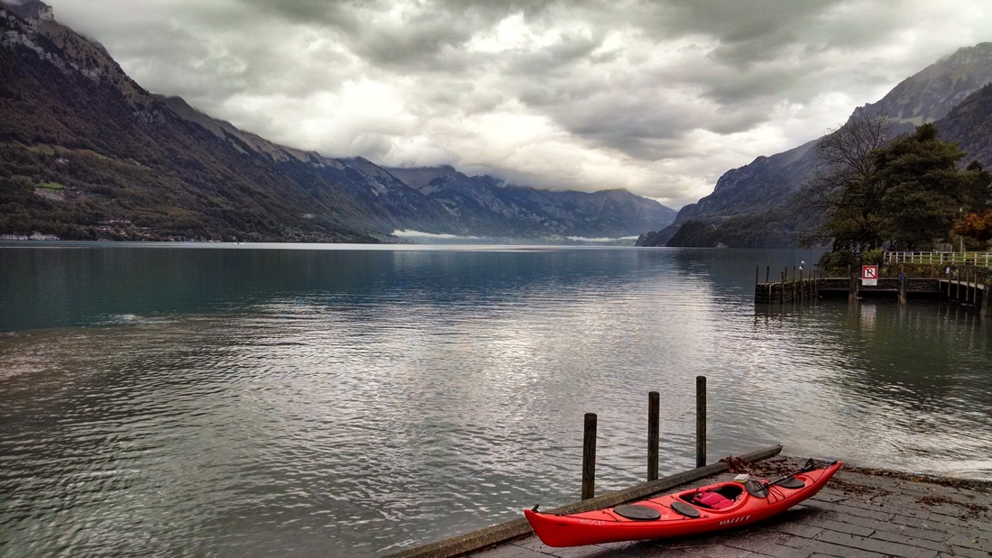
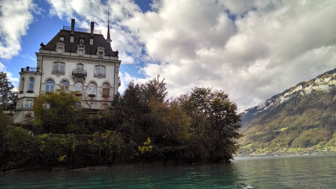
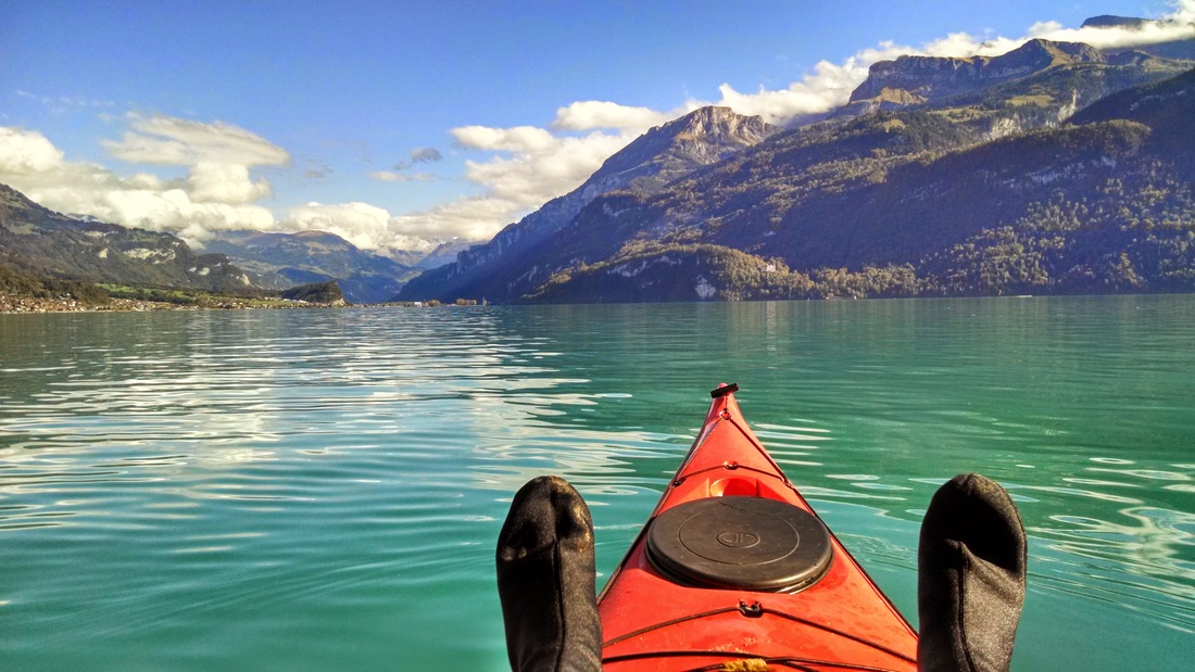
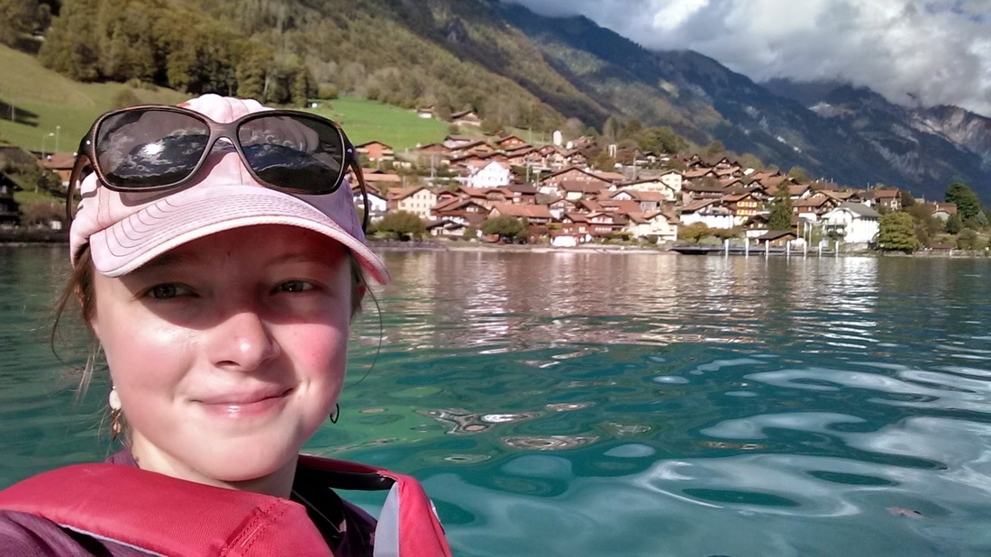
Lake Brienz (Brienzersee in German) is one of two lakes that flank the city of Interlaken, Switzerland. Unlike the Lake Thun (the other lake), Lake Brienz is a vibrant turquoise blue color, likely caused by glacial sediments flowing into the lake. I rented a boat from Hightide Kayak School in Bönigen (next to Interlaken) and embarked on my longest solo paddle yet. As you can see from the photos below, the views and weather were fantastic!
Note: I'm trying out a new layout with this post, with all photos + captions up front and the detailed trip description later on. Let me know what you think!
Note: I'm trying out a new layout with this post, with all photos + captions up front and the detailed trip description later on. Let me know what you think!


Background & travel logistics
How did I end up in Switzerland? Back in September, I was craving a kayaking trip of more epic proportions than the heavily controlled/artificial canals that most of Holland offers. I sent a few emails to kayak businesses in Italy, Switzerland, and the UK (anywhere with a cheap flight), asking about sea kayak rentals. Since I'm on quite a budget this year, I was looking for gear rental rather than guided trips or instruction. Dave at Hightide Kayak School in Interlaken was quick to respond and open to renting equipment (including spray skirt, etc) to an experienced paddler. He even had a Valley Avocet - the same as my beloved Big Purple back in the US. Though the full-day rental was a bit pricey (90 CHF or $100 USD), I was sold.
I invited Sander, a friend from Delft, to join on the 4-day trip, which involved more than just kayaking. We flew into Basel (~140€ EasyJet, including 1 checked bag) and took a 2 hour train to Interlake (Supersaver tickets, ~$30 each way). We stayed at Camping Talacker (~$20/night), in a village called Riggenburg on the north shore of Lake Brienz. The campground was lovely, with quiet views of the lake, nice bathroom/shower facilities, but without an overly touristy feeling. Bus 102 from the train stations in Interlaken dropped us off very close to the campground.
I invited Sander, a friend from Delft, to join on the 4-day trip, which involved more than just kayaking. We flew into Basel (~140€ EasyJet, including 1 checked bag) and took a 2 hour train to Interlake (Supersaver tickets, ~$30 each way). We stayed at Camping Talacker (~$20/night), in a village called Riggenburg on the north shore of Lake Brienz. The campground was lovely, with quiet views of the lake, nice bathroom/shower facilities, but without an overly touristy feeling. Bus 102 from the train stations in Interlaken dropped us off very close to the campground.
The kayaking part
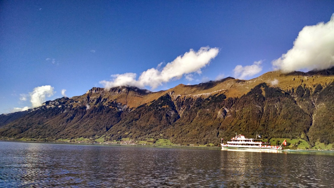
On Friday morning I arrived (via bus) in Bonigen around 11am, after most of the rain had stopped. I got myself set up with paddling gear, rolling my boat down to the launch between Hotel Seiler au Lac and Hotel Oberlanderhof. A few elderly men walked by and said friendly things in German, which I understood to be about how lovely Lake Brienz is. I smiled and was on my way. Since tourist season ends in October, I was the only boat on the lake. Over the entire day I only saw one rowing shell, one fisherman in a motor boat, and one canoe. Cow bells clanged on the hillside near the launch, but otherwise the lake was quiet. Cloudy, cool, and calm weather, like that morning, is always my favorite for kayaking. There's no need to squint or worry about sunburn.
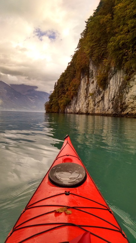
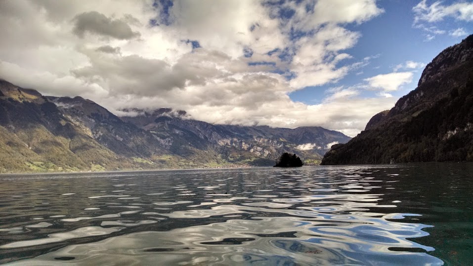
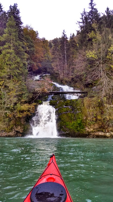
Iseltwald is the main town on the southeast shore of Lake Brienz (population ~400). Most of this shore is undeveloped and characterized by steep cliffs and forested hillsides. The town of Iseltwald is a quintessential photogenic Swiss town (see photos above). From there, I continued on to a small island (the only island in the lake), which is called Schnäggeninseli ("Snail Island"). I paddled around the island, which was blocked off by a fence. An unfriendly-looking German sign on the fence blocking the boat launch kept me from exploring any further. Further along, I arrived at the Giessbach ferry terminal. A steep cable car transports passengers up to the Grand Hotel Giessbach (see photos). Nearby, the Giessbach Falls (12 of them) tumble down the steep mountainside into the lake. I paddled up near the waterfall, much to the amusement of tourists on the bridge above.
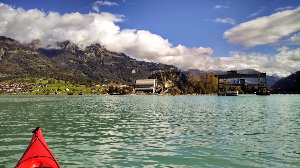
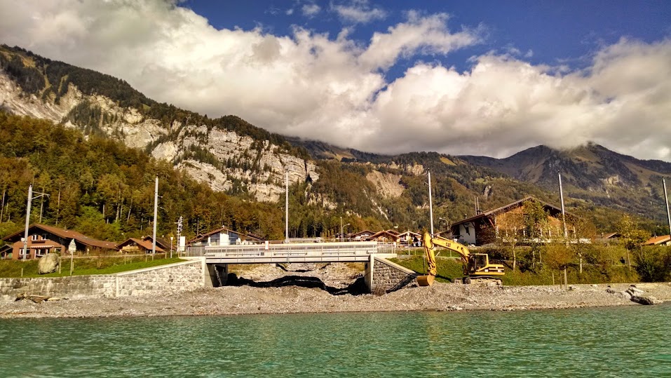
Around 2pm I reached the east end of the lake. I paused to watch a dredging operation at the mouth of the Aare River, where a machine was scooping up massive loads of gravel from the bottom of the river and placing them on a barge (see photo). Nearby, a plant seemed to be processing the gravel (I'm assuming they were related). My non-existent German skills are preventing me from Googling for more information.
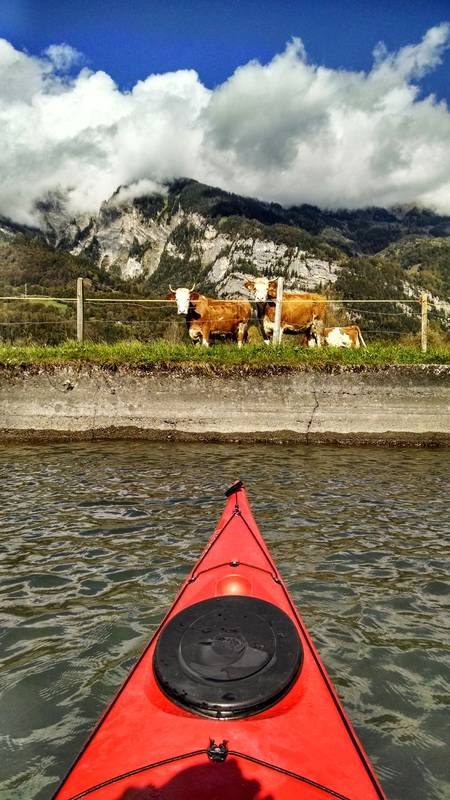
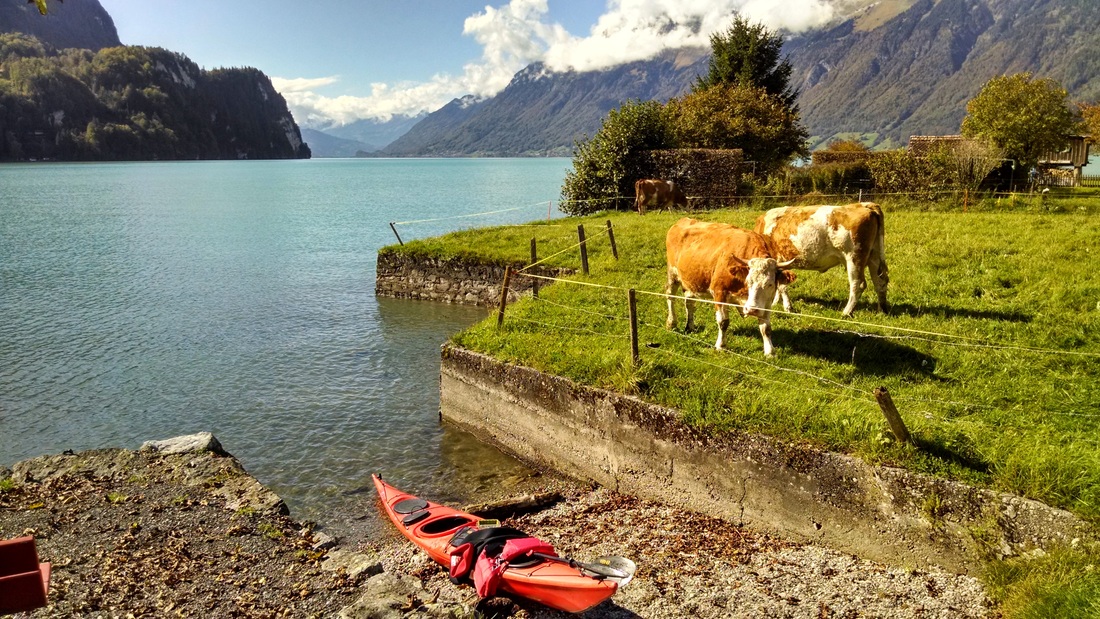
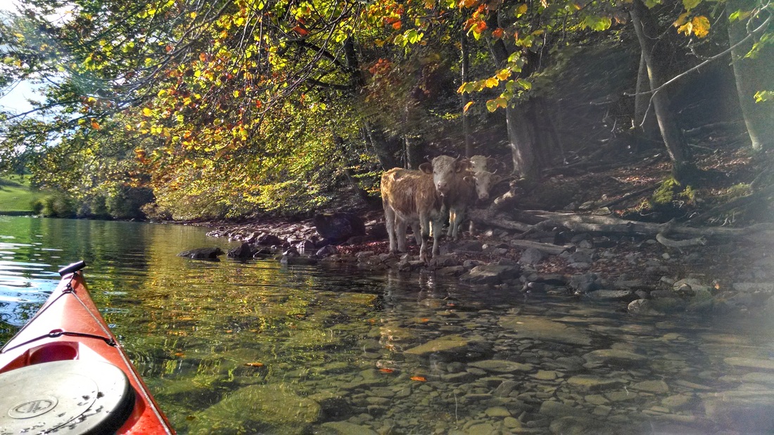
I stopped for lunch at a typical red tourist bench next to a cow pasture. The cows watched me curiously as I landed my kayak and ate a PB&J sandwich. After this short stop, I continued past the city of Brienz. Seawalls/revetments and other hard structures line much of the developed shores along the north side of the lake. Most creeks have been straightened through concrete channels. I stopped to look more closely at the mouth of Glyssibach (bach = brook), a steep mountain drainage that flows through Brienz. Huge shallow gravely deltas sprawl from the mouths of these creeks, whereas most of the lake is very steep/deep around the edges (~856 ft deep at the deepest point!). It looks like quite a bit of maintenance is necessary to clear the channels of gravel deposits after major storms (see excavator in photo above). While concrete channels like the examples above reduce flooding, they also remove much of the natural variability in creeks/rivers that is necessary for a healthy ecosystem... I won't get into that now, though :)
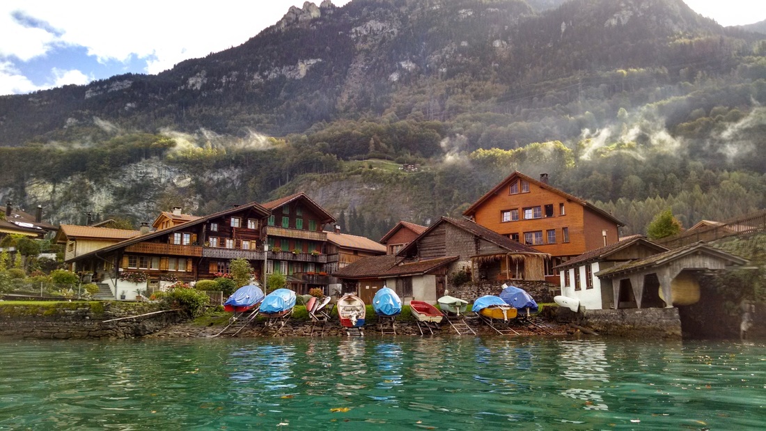
The paddle back to Interlaken was uneventful, with many cute lakeside towns, cows in the woods, and ferry terminals. Near the Riggenburg ferry terminal I had to maneuver a bit to avoid two passing ferries. I crossed the highly turbid and turbulent mouth of the Lütschine River. The Lütschine and Aare Rivers merge in Lake Brienz and flow through Interlaken to neighboring Lake Thun. A few minutes later, I was back at the launch site, happy, tired, and filled with that post-kayaking LIFE-IS-THE-BEST feeling that I had been craving. :) Happy Paddling!
Iseltwald is the main town on the southeast shore of Lake Brienz (population ~400). Most of this shore is undeveloped and characterized by steep cliffs and forested hillsides. The town of Iseltwald is a quintessential photogenic Swiss town (see photos above). From there, I continued on to a small island (the only island in the lake), which is called Schnäggeninseli ("Snail Island"). I paddled around the island, which was blocked off by a fence. An unfriendly-looking German sign on the fence blocking the boat launch kept me from exploring any further. Further along, I arrived at the Giessbach ferry terminal. A steep cable car transports passengers up to the Grand Hotel Giessbach (see photos). Nearby, the Giessbach Falls (12 of them) tumble down the steep mountainside into the lake. I paddled up near the waterfall, much to the amusement of tourists on the bridge above.
Around 2pm I reached the east end of the lake. I paused to watch a dredging operation at the mouth of the Aare River, where a machine was scooping up massive loads of gravel from the bottom of the river and placing them on a barge (see photo). Nearby, a plant seemed to be processing the gravel (I'm assuming they were related). My non-existent German skills are preventing me from Googling for more information.
I stopped for lunch at a typical red tourist bench next to a cow pasture. The cows watched me curiously as I landed my kayak and ate a PB&J sandwich. After this short stop, I continued past the city of Brienz. Seawalls/revetments and other hard structures line much of the developed shores along the north side of the lake. Most creeks have been straightened through concrete channels. I stopped to look more closely at the mouth of Glyssibach (bach = brook), a steep mountain drainage that flows through Brienz. Huge shallow gravely deltas sprawl from the mouths of these creeks, whereas most of the lake is very steep/deep around the edges (~856 ft deep at the deepest point!). It looks like quite a bit of maintenance is necessary to clear the channels of gravel deposits after major storms (see excavator in photo above). While concrete channels like the examples above reduce flooding, they also remove much of the natural variability in creeks/rivers that is necessary for a healthy ecosystem... I won't get into that now, though :)
The paddle back to Interlaken was uneventful, with many cute lakeside towns, cows in the woods, and ferry terminals. Near the Riggenburg ferry terminal I had to maneuver a bit to avoid two passing ferries. I crossed the highly turbid and turbulent mouth of the Lütschine River. The Lütschine and Aare Rivers merge in Lake Brienz and flow through Interlaken to neighboring Lake Thun. A few minutes later, I was back at the launch site, happy, tired, and filled with that post-kayaking LIFE-IS-THE-BEST feeling that I had been craving. :) Happy Paddling!
A bit of water nerding...
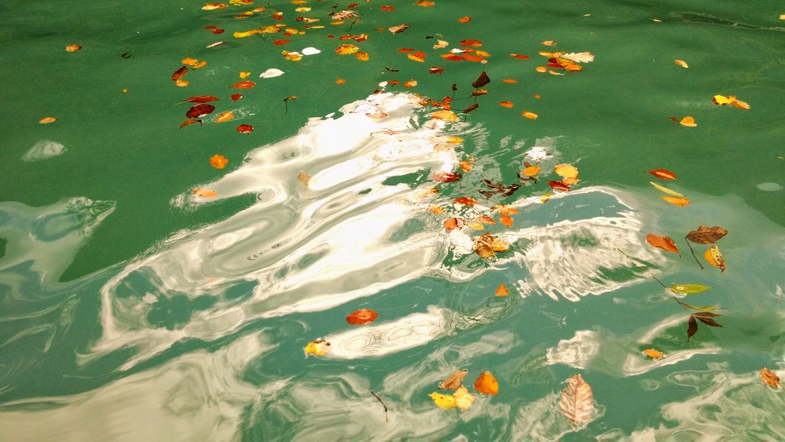
The first thing I noticed about Lake Brienz was its bright blue/turquoise color in Google Maps. According to this 1978 paper, 18% of the lake's drainage area was glaciated in 1978. Glacial runoff tends to carry fine silt into downstream lakes. These fine particles stay suspended in the water rather than settling to the bottom and reflect blue/green light. In this way, Lake Brienz reminds me of Lake Louise in Banff National Park, Canada. What I can't find an explanation about, is why Lake Thun doesn't have this characteristic color. Lake Brienz flows into Lake Thun via the Aare River, so shouldn't it be the same color?
2005 - Floods in Interlaken
In August 2005, massive flooding struck Switzerland, especially Bern, Interlaken, and Lucerne. This link shows photos of the flooding (#10, 11, and 14 are in places around Lake Brienz). While similar storms happen every year, the duration, wide spatial extent, and intensity of the storm made it the largest in over 100 years. In many locations 8 inches of rain fell in 48 hours. Runoff led to massive erosion, landslides, dike failures, log jams, and of course extensive flooding. Many of the flood channels that I observed around Lake Brienz were constructed after the 2005 storms. Detention basins are often included in these channels and store large volumes of water and encourage debris/rocks to settle out before flowing through town. Glyssibach was one example of this (see photo above and at this link).
1996 - Major turbidite deposition
In 1996 a major sediment slide even occurred under water in Lake Brienz (Girardclos et al 2007). Three observations led to this discovery: (1) a spike in turbidity and a drop in dissolved oxygen measurements, (2) a small tsunami wave (0.5 m) that caused two dredging cables to snap on an otherwise sunny and wave-less day, and (3) a human corpse, without head, lower legs and right arm, and partly covered by a blue vivianite coating, floated up to the surface and was found near shore. The body was carbon dated and estimated to have drowned between 1719–1818.
Ok, do I have your attention now? What the heck is turbidite? I decided to investigate. Turbidite is a layer of sediment that was deposited at the bottom of the ocean (or lake, in this case) in a turbid flow. In a turbid flow the water is chock full of suspended sediment. This results in overall "denser" water that has the capacity to pick up and move larger sediment than would otherwise happen. All this sediment moving around results in more turbid water. The large and sudden movement caused the water surface to drop in one location, creating a tsunami-like wave (tsunamis are often caused by underwater landslides). The loosening of sediments released the ancient corpse. Surprise!
Date: Friday, October 17th, 2014
Distance: 20 miles (32 km) kayaking
Duration: 5.5 hrs + 0.5 hr lunch break (wow! I think this was also one of my fastest trips)
Distance: 20 miles (32 km) kayaking
Duration: 5.5 hrs + 0.5 hr lunch break (wow! I think this was also one of my fastest trips)
 RSS Feed

