A quick nap on the way to Mt. Baker.
Monday morning we “slept in” and made a dinner-breakfast of spaghetti with tomato sauce, supplemented with mushrooms and chard – yum! Sara and I packed up our tents and left camp earlier than the rest of the crew. Everyone else was headed back to Anacortes later that morning, but we were headed to Orcas Island to continue the second half of our San Juan Islands trip. Even after multiple calls to the Southwest Airlines baggage counter (at 3 different airports), there was no indication that Sara’s two checked bags would be delivered, so we headed into Friday Harbor to replace some of the lost items. A 45-minute shopping spree later, Sara was the proud owner of some new chacos, underoos, paddling gloves, and other items. We made the usual stops for water, ice, and coffee before boarding the inter-island ferry.
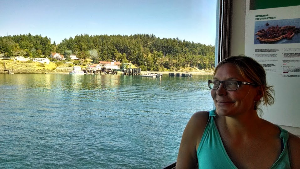
The ferry from San Juan Island to Orcas Island took ~1 hour, during which I wrote postcards and Sara enjoyed the warm sun on the deck.
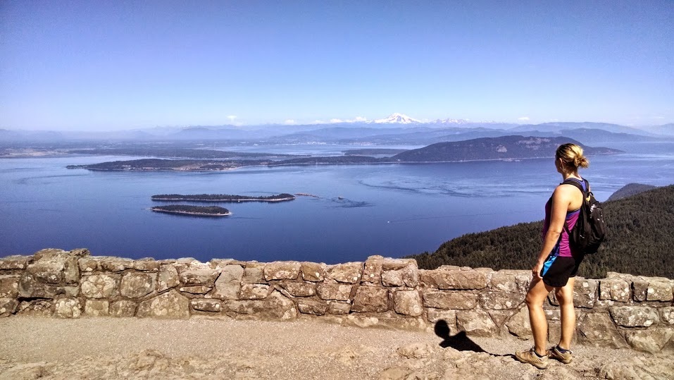
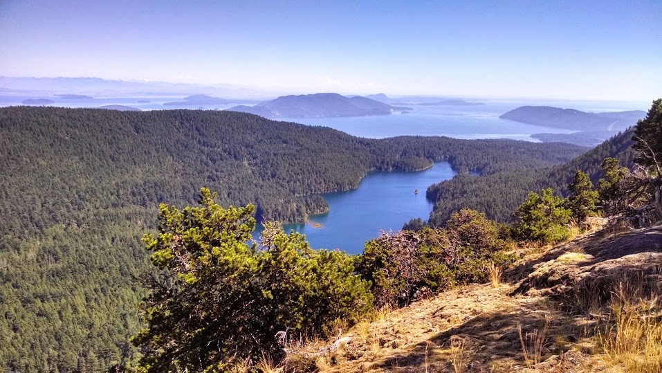
Orcas Island is shaped like an upside-down U, with the ferry terminal on the west end and Moran State Park (our campground) on the east side. During our drive we stopped at Eastsound, at the inland end of East Sound (the water body that makes the island look like a U). We stopped in at the first kayaking shop we encountered and purchased a map of the island. One of the employees was incredibly helpful and marked all the launch sites around the island, explaining which would require checking the tides and which are generally current-less. He even gave us their phone number in case we wanted to call for a weather update. Upon arriving at Moran State Park, the check-in lady gave us some hiking recommendations that we pursued after setting up camp. We settled on a 6.7 mile loop that starts at Mountain Lake (a couple miles from our campsite), moves steeply up Mount Constitution past Summit Lake, drops again to Twin Lakes, and meanders back along the west side of Mountain Lake. The views from the top of Mt. Constitution were stellar – the day was perfectly clear and we had nearly 360 degree views of the San Juan Islands and more distant mountain ranges. Snowy Mount Baker was most prominent on the horizon.
Orcas Island is shaped like an upside-down U, with the ferry terminal on the west end and Moran State Park (our campground) on the east side. During our drive we stopped at Eastsound, at the inland end of East Sound (the water body that makes the island look like a U). We stopped in at the first kayaking shop we encountered and purchased a map of the island. One of the employees was incredibly helpful and marked all the launch sites around the island, explaining which would require checking the tides and which are generally current-less. He even gave us their phone number in case we wanted to call for a weather update. Upon arriving at Moran State Park, the check-in lady gave us some hiking recommendations that we pursued after setting up camp. We settled on a 6.7 mile loop that starts at Mountain Lake (a couple miles from our campsite), moves steeply up Mount Constitution past Summit Lake, drops again to Twin Lakes, and meanders back along the west side of Mountain Lake. The views from the top of Mt. Constitution were stellar – the day was perfectly clear and we had nearly 360 degree views of the San Juan Islands and more distant mountain ranges. Snowy Mount Baker was most prominent on the horizon.
The deep and crystal clear waters of Mountain Lake beckoned us upon our return to the car, so we jumped in to refresh ourselves before driving to the northern-most point of the Island (end of North Beach Road) to go for a sunset paddle. Unlike in California, the beaches here are not necessarily public. At the end of the road was a narrow parking lot fronted by a cobble beach with views of the Cascades to the left and Mount Baker to the right. Signs marked private property on either side of the very small public beach. We perched ourselves on a large driftwood log (abundant in these islands) to have a lunch-dinner of pitas with the usual veggie/hummus toppings, complete with honey-topped saltines for dessert.
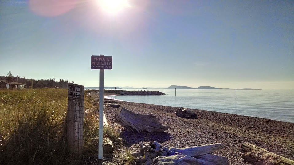
Private property signs on both sides of the public beach.
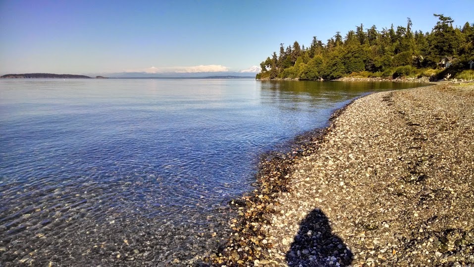
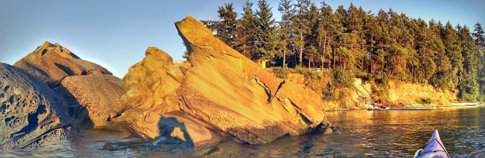
Eastern view from the cobble beach launch site.
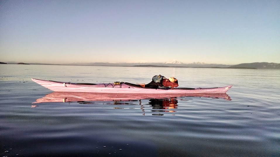
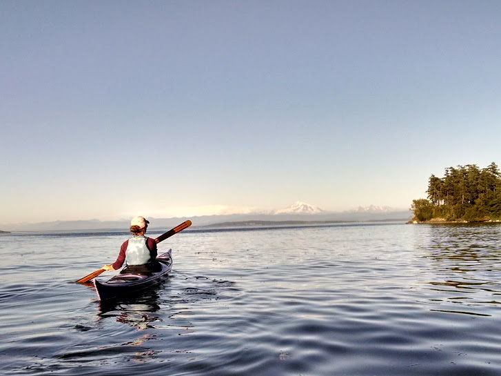
Stuffed with delicious food, we speedily unloaded Big Purple and Renaldo onto the increasingly crowded beach (it was empty when we arrived). After a brief mishap that resulted in Renaldo dumping Sara into the water (thank god for the wetsuit!), we were headed east along the shore. It was 7:20pm, so the sun was still high in the sky. We paddled towards snowy Mt. Baker, with glassy waters all around. A seal splashed in distance, and small jumping fish greeted us every stroke of the way. We continued to the northeast point of the island, where we spent a few minutes having a photo shoot in what might be the most scenic view I've ever experienced in my kayak.
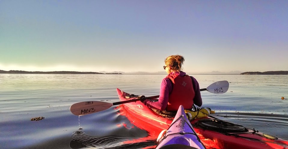
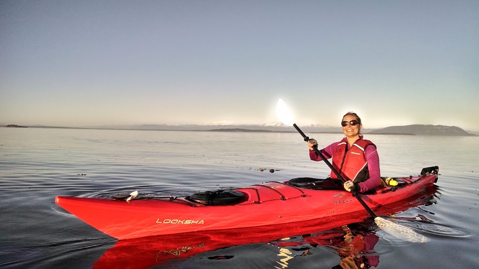
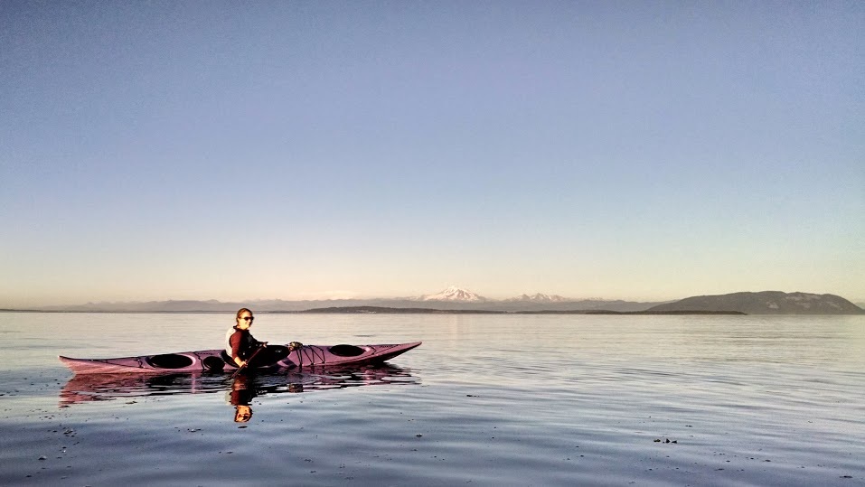
The setting sun was still blazing at our backs, so turning around wasn't an option (way too painful on the eyeballs). Instead, we hugged the shady parts of shore and turned into a small rocky beach where Sara searched for colorful pebbles and I took a “nap” in my boat. When the sky began to turn orange and the sun’s intensity dropped, we started heading back, witnessing a gorgeous sunset along the way. Mt. Baker evolved to different shades of purple and orange behind us. After the sun went down, the mountain ranges turned different shades of blue, grey, and purple, and Sara noted that this looked like every postcard she'd seen.
Rocky point where we stopped to wait for the sun
Back at the beach, we quickly loaded the boats and wet gear into the car, with one bystanding biker expressing his love for Renaldo. Sadly, my head was pounding from a migraine, so we headed straight back to the campsite (#112) with only a quick stop to pick up water and a wine opener. Sara enjoyed an evening of showering, reading, and red wine, and I went immediately to bed!
Date: Monday, July 28th 2014
Distance: 3 miles
Duration: 1.5 hrs?
Date: Monday, July 28th 2014
Distance: 3 miles
Duration: 1.5 hrs?
 RSS Feed

