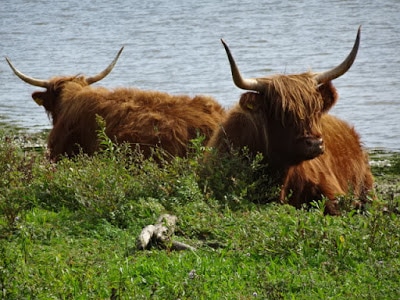
Scottish Highland Cows - the largest residents of Tiengemeten. Photo from http://quiltingjeannet.blogspot.nl/ because I couldn't get close enough...
|
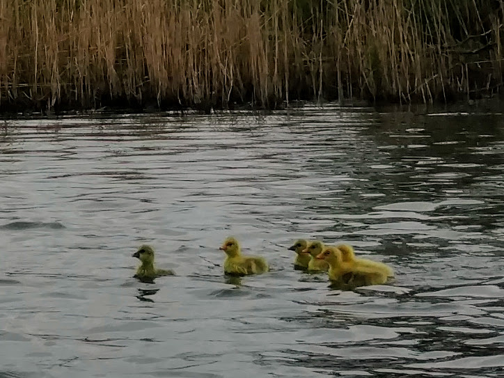
Ducklings peeping along the coast of Tiengemeten.
|
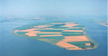
Tiengemeten, population 10, is an island in the Haringvliet named after its size (tien = 10, gemeten = ancient unit of measurement corresponding to approximately 1 acre). It started out as a sandbar in the Haringvliet estuary (which has since been blocked off from the sea and turned into a freshwater lake), and eventually grew to be an island between 1750 and 1804. After that it underwent all kinds of changes and development. Yesterday, Tom, Amelia, Iede, and I kayaked around it. Read on to see some cool photos of wetland restoration and find out what makes this island unique (from a kayaking and historical perspective)!
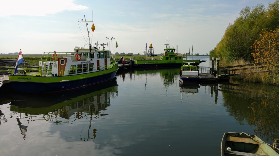
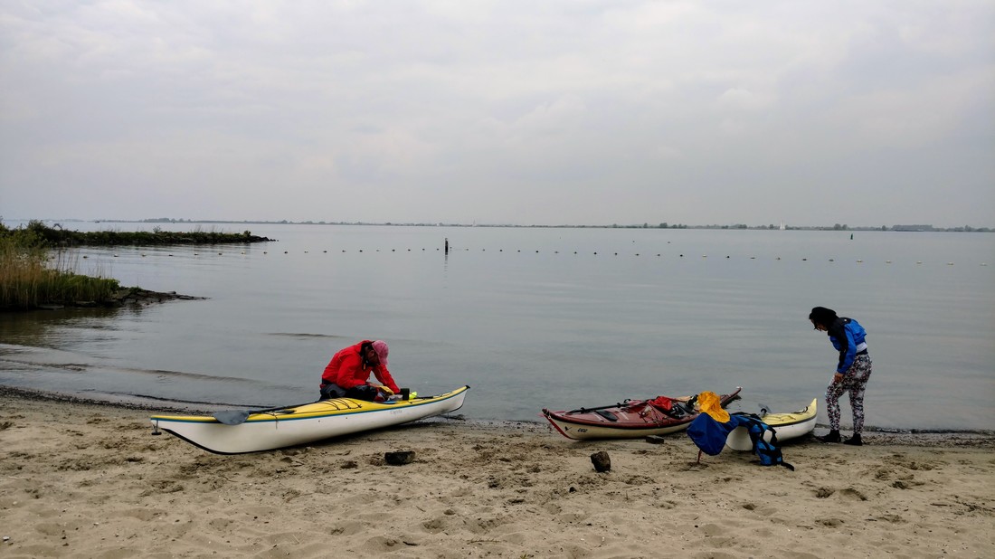
We arrived at the small harbor at Nieuwendijk around 10am. Kayak/canoe launch to the right (outside the photo).
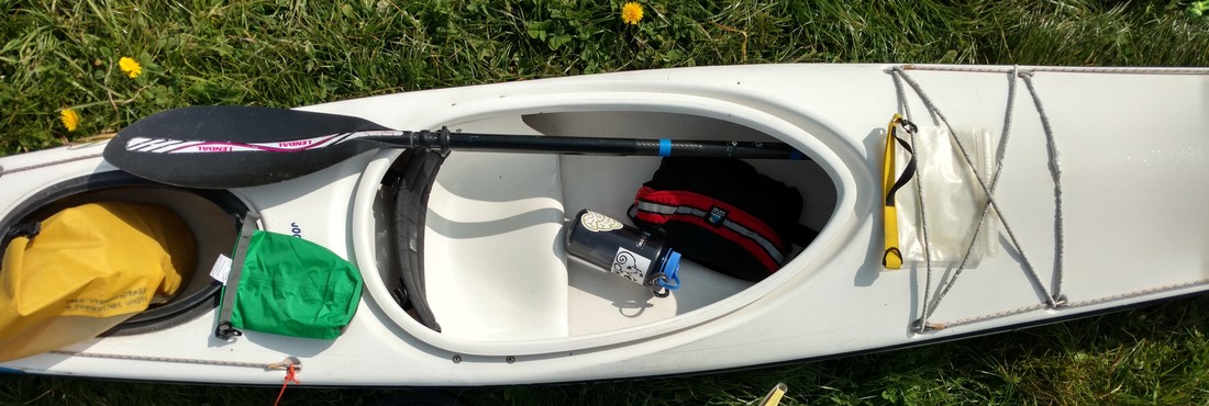
Ever since I looked at a Google map of the Netherlands (closely), I've been intrigued by Tiengemeten. It stood out because it was totally "green" (i.e. designated as a part) and had essentially no roads, something that's pretty rare in the Netherlands. This weekend I finally had a chance to explore it by kayak. Iede, Tom, Amelia, and I met at the clubhouse in Rotterdam at 9am to load the boats and drive to the launch site at Nieuwendijk. I drove Iede's car because he'd be spending the night on the island with Tom while Amelia and I would drive back later, and he wanted to make sure I knew how to drive. Though I've been in a kayak seat much longer than behind a steering wheel, driving is one American activity that I'm a fan of. A few revs of the engine later, we were off!
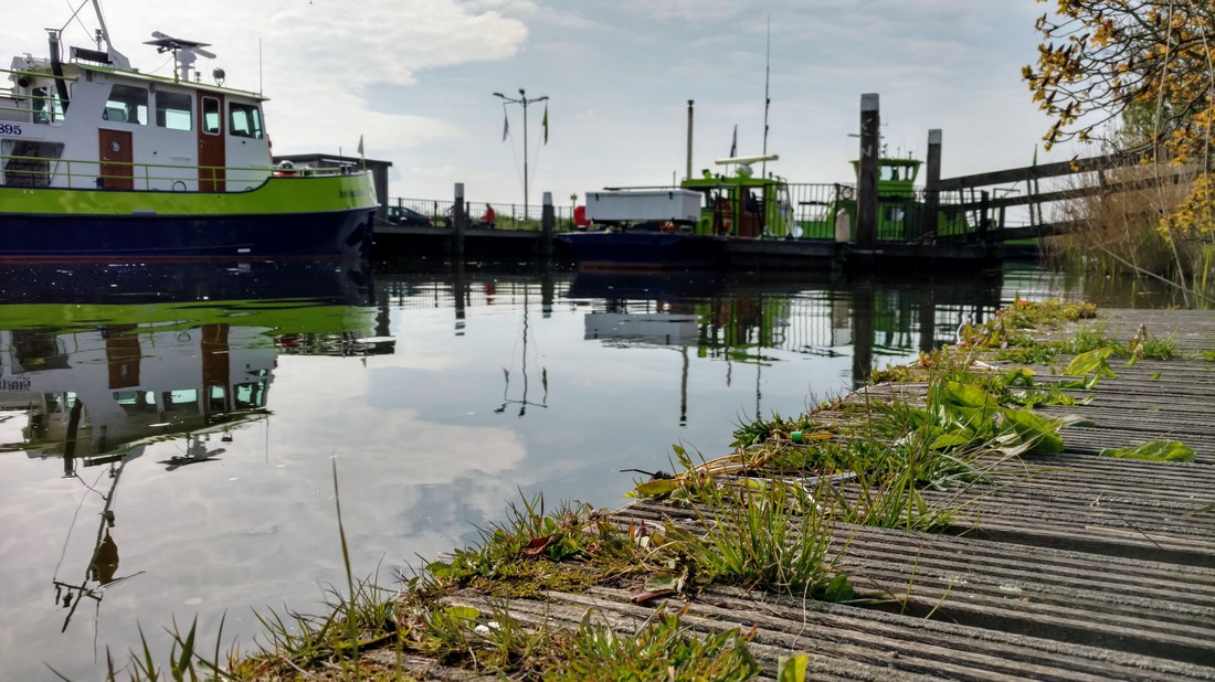
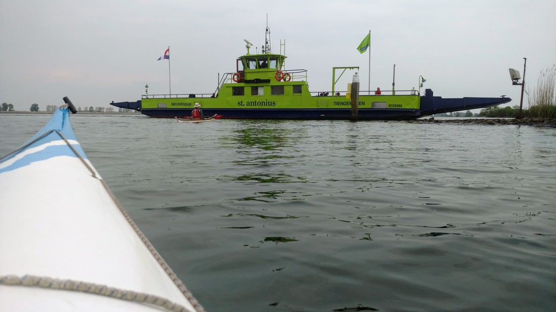
Artsy photo from the kayak/canoe dock. Green/blue boats are ferries to Tiengemeten.
A brief history of Tiengemeten...
Before jumping into the post, I'd like to introduce you to Tiengemeten. Tiengemeten came naturally into existence as a raised sand berm in the Haringvliet estuary somewhere in the ~1600s. In the late 1700s, it was developed and poldered (diked and drained) for agriculture. At one point, the island was also used as a quarantine site for ships that had visited the East Indies, before they could continue on to Dordrecht. In the late 1900s, as agriculture became less profitable, many proposals were made about what to do with the island: recreation, contaminated waste site, freight airport, nuclear power plant. In the 1990s, most of the farmers were bought out and the island was converted to a nature park, with the last farmer leaving in 2007. Today it can be accessed by bike or foot via a small ferry that runs from Nieuwendijk.
... but accessing it by kayak is WAY more fun. ;)
... but accessing it by kayak is WAY more fun. ;)
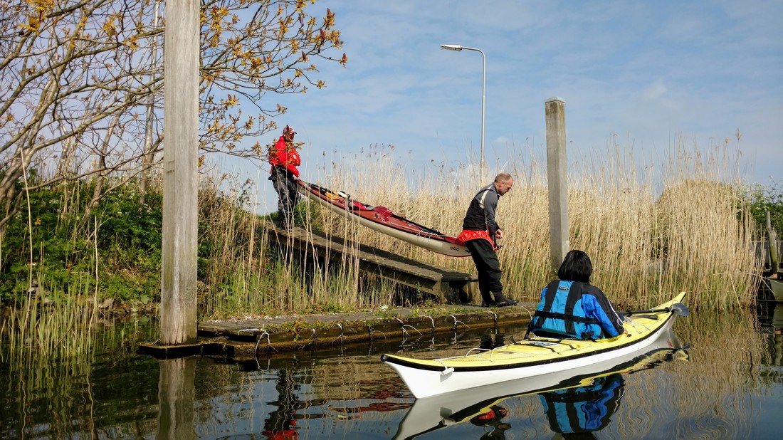
Amelia drifting and Tom and Iede carrying down Iede's fully-loaded boat.
"I don't smile for photos" -Iede
Amelia, and a couple wild cows in the background (in the grass on the right of the photo...)
Let's talk about hydrology...
So why was the island converted into a nature park? In 1970, the Haringvliet estuary was closed off from the North Sea by a series of tide gates, installed to control water levels and prevent flooding (in response to the great floods of 1953). This resulted in nearly complete reduction of tides (from 2 m to 30 cm) and conversion from a saline to mostly freshwater system, as sea water was kept out. In response, the marshes and mudflats shrunk drastically. (I think) the restoration was done to partly offset the effects of the flood gates. Now, there are larger plans in the works to allow more water in and out from the North Sea, to eventually create a 60 cm tide and somewhat better habitat.
"Since its return to nature, Tiengemeten has become a real wilderness with trackless terrain, flowing creeks and gullies, meadows full of flowers and huge populations of migrating birds, including ospreys and egrets. Some of the marshy pastures are grazed by Highland cattle and other hardy animals." - Wikipedia
Restoration of Tiengemeten
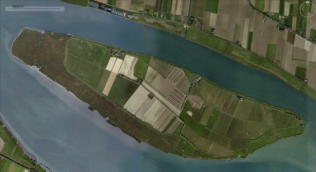
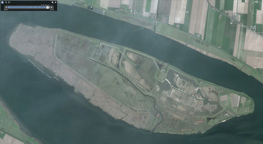
In 2007, all of Tiengemeten was designated a nature park. Once the farmland was freed up for restoration, breaches were made in multiple locations along the dikes (see photo below), and some tidal channels excavated (see aerial photo comparison below).
Tiengemeten before restoration. Source: Rijkswaterstaat Beeldbank.
|
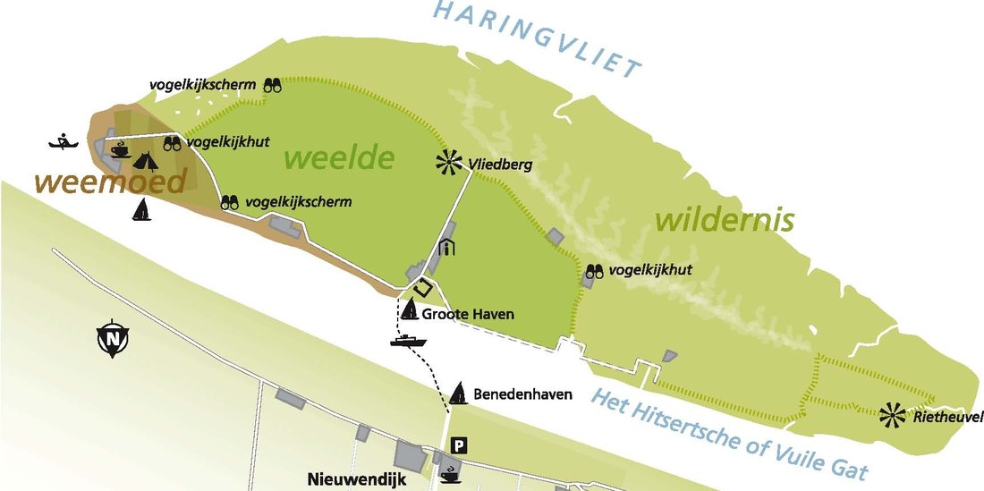
Map showing the three regions of Tiengemeten. Source: https://plazilla.com/page/4295002632/een-dagje-uit-in-de-natuur-het-natuureiland-tiengemeten
|
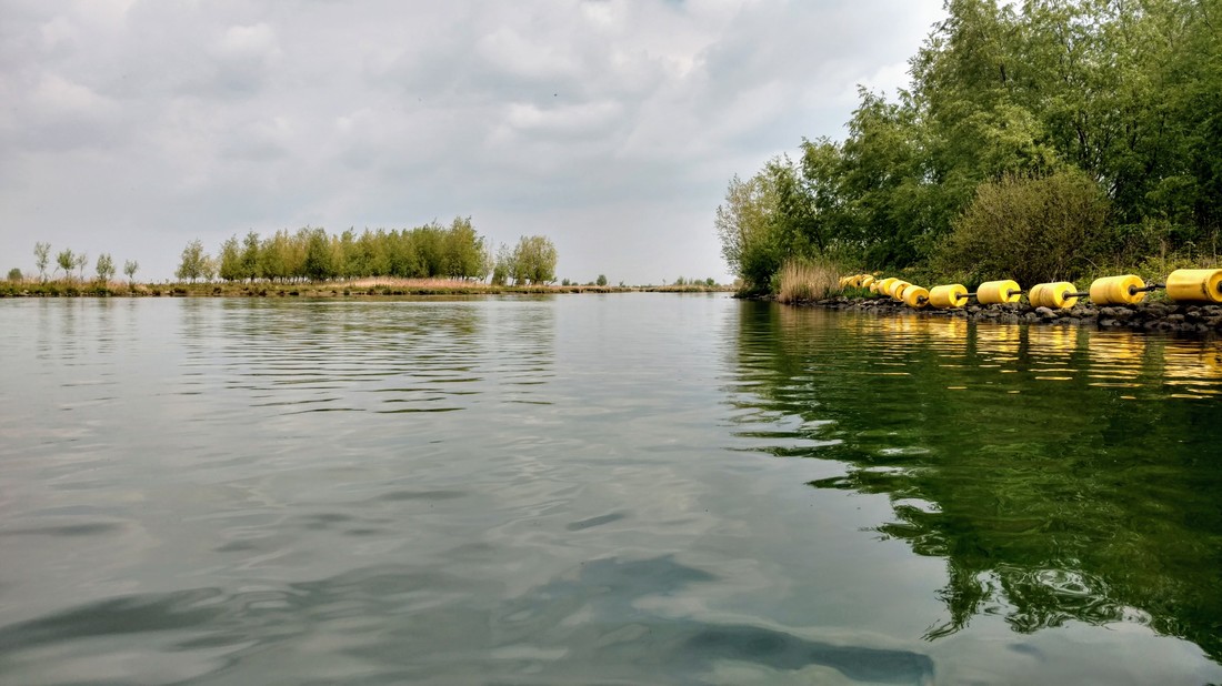
Levee breach on the southern side of the islands - part of the new tidal channel excavated during island restoration.
Before and after construction: aerial photos
Below are some aerial photos from Google Earth. Click to enlarge and toggle between them. In 2005, the agricultural landscape is still completely intact. The western and southern sides of the island were natural tidal marsh. On the right, you see that water can now enter many formerly diked areas, especially along a couple major channels that were dug during the "restoration". The eastern tip of the island remains diked and developed (nature center/campground). It is definitely still in an awkward adolescent phase, but each year (and storm) that passes, it will be one step closer to a more natural state.
I didn't have a chance to explore the island itself, so I'll have to return with a bike to see this proliferation of wildlife... What I found particularly interesting about the island was the approach taken in communicating the restoration project to the public. During its conversion to nature park, the island was divided into three distinct areas (see map above):
1. Weelde (Wealth) - An area of biological richness and diversity.
2. Weemoed (Nostalgia) - An area where the historic farming culture has been preserved.
3. Wilderness - Where nature dominates (it's not 100% clear to me how this is different from Weelde - I think Weelde are areas in the middle of the island that subsided heavily due to draining, creating a low, sheltered, wet area that appears to be popular bird habitat).
This interesting paper provides a better discussion about these areas and why they're communicated differently to the public. If you found this discussion (and before/after pictures) interesting, you can check out my write up from another trip through a restoring marsh - at the Jantjesplaat in the Biesbosch.
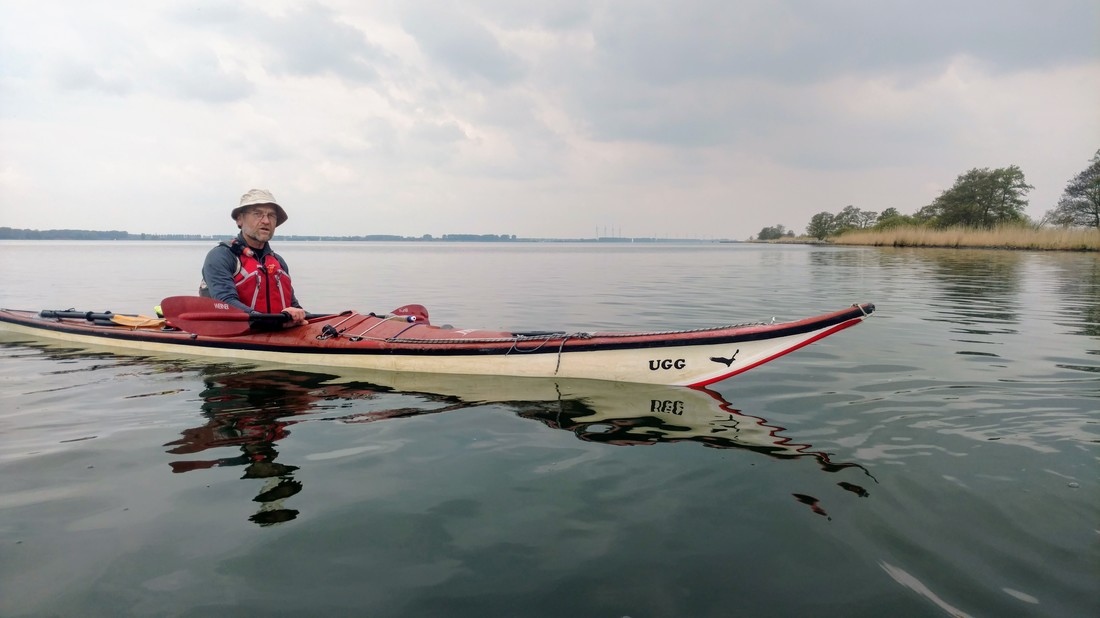
Okay, now that we know lots about Tiengemeten, let's get back to the kayaking part. We circumnavigated the island in a clockwise direction, in an effort to have the wind at our backs. However, there was virtually no wind so we could have gone either way. I'm beginning to think the Dutch kayaking conditions are always calm. :)
Since most of the island is strictly designated "wilderness," and no boaters (including non-motorized craft) are permitted to land, we went to a beach on the mainland for lunch (see map at end of this post). On the way to lunch, Iede and I chit-chatted about all kinds of IT-related things since he's a software engineer and my newest task at work involves a diagram that looks like this. While I can't say my work task is much clearer, it's comforting to know a non-work person who understands!
Since most of the island is strictly designated "wilderness," and no boaters (including non-motorized craft) are permitted to land, we went to a beach on the mainland for lunch (see map at end of this post). On the way to lunch, Iede and I chit-chatted about all kinds of IT-related things since he's a software engineer and my newest task at work involves a diagram that looks like this. While I can't say my work task is much clearer, it's comforting to know a non-work person who understands!
This beach isn't actually on Tiengemeten (since there are few legal landing spots), but it's very close by.
|
When we landed, we promptly went searching for pee spots. I cannot recommend this beach for the ladies - the best I could find was a thorn-infested, unstable, rocky, slope with sparse coverage. We then headed up to the grassy field (because Dutch people seem to take issue with sitting on the beach... something about taking good care of our gear? :), where we were initially attacked by a swarm of mosquito-esque bugs. I swatted a mosquito on my leg, and Tom said "Not much of an outdoorsy person, are you?" to which I responded "I'm not much of a mosquito-bite-on-my-inner-thigh kind of person... are you?" Touché! (I think).
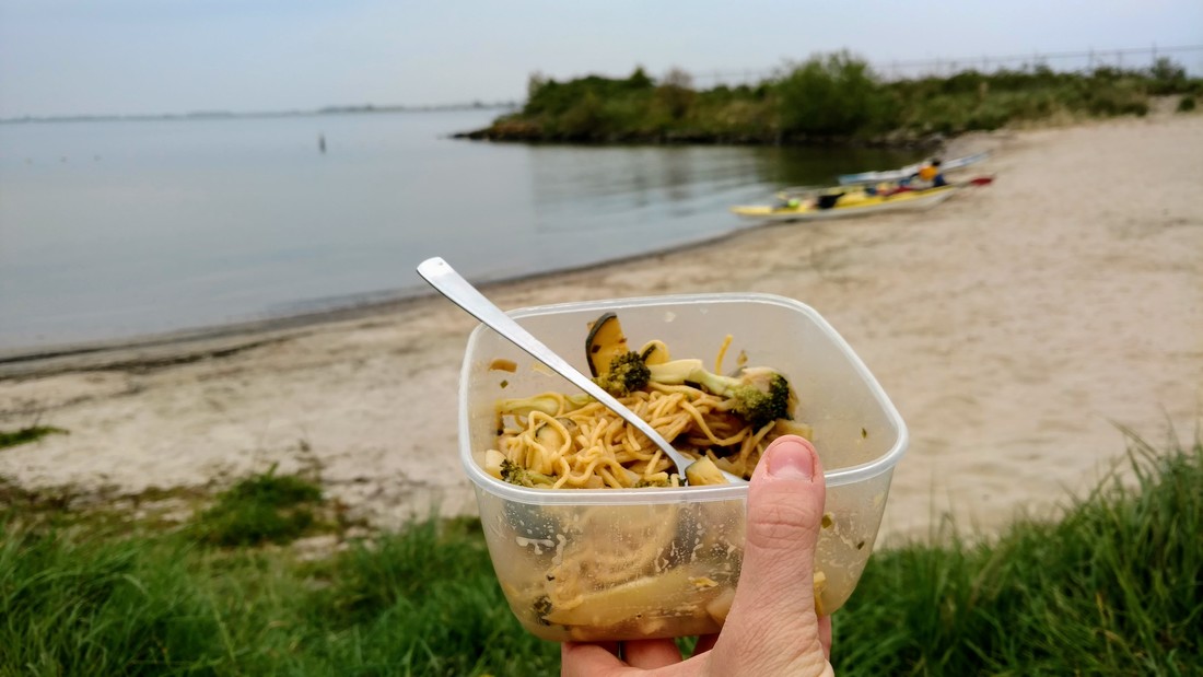
Amelia and I drank tea and ate pasta, Tom and Iede brewed coffee of varying quality, and we all munched on Amelia's potato chips. I took some artsy photos of my noodle tupperware. I'm really enjoying the artsy close-ups lately... All sarcasm aside, it was a very enjoyable lunch, and I learned a lot about the history, politics, an impending rebuild of the Never Dry club. |
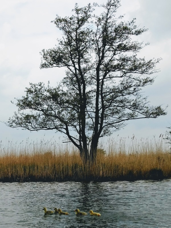
Adorable ducklings! We might have scared away their mother though :(
|
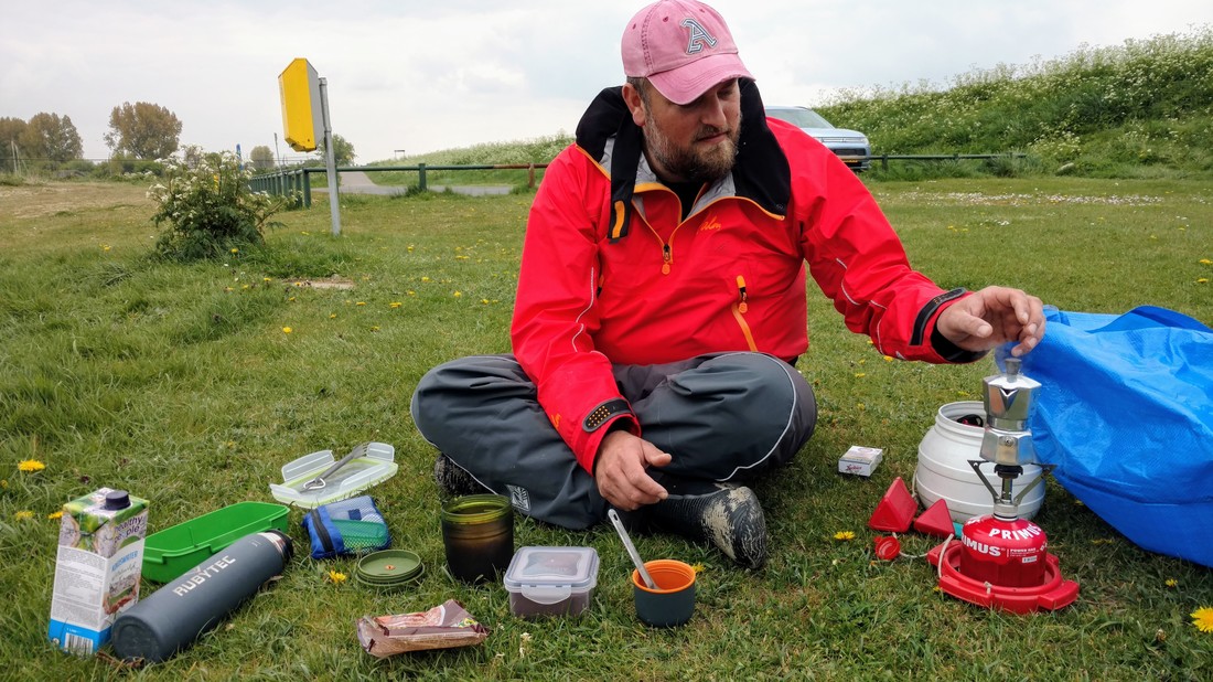
Tom with his fancy espresso machine at lunch. To his credit, he was spending the night on the island...
After lunch we headed back to Tiengemeten to finish up our circumnavigation. One thing that struck me was that even along the more natural western end of the island, rocky breakwaters lined the entire edge. Apparently this is to prevent erosion when storms whip up some big waves. I guess the island is permitted to be "natural" within those rocky limits, but not evolve morphologically (i.e. erode, reshape).
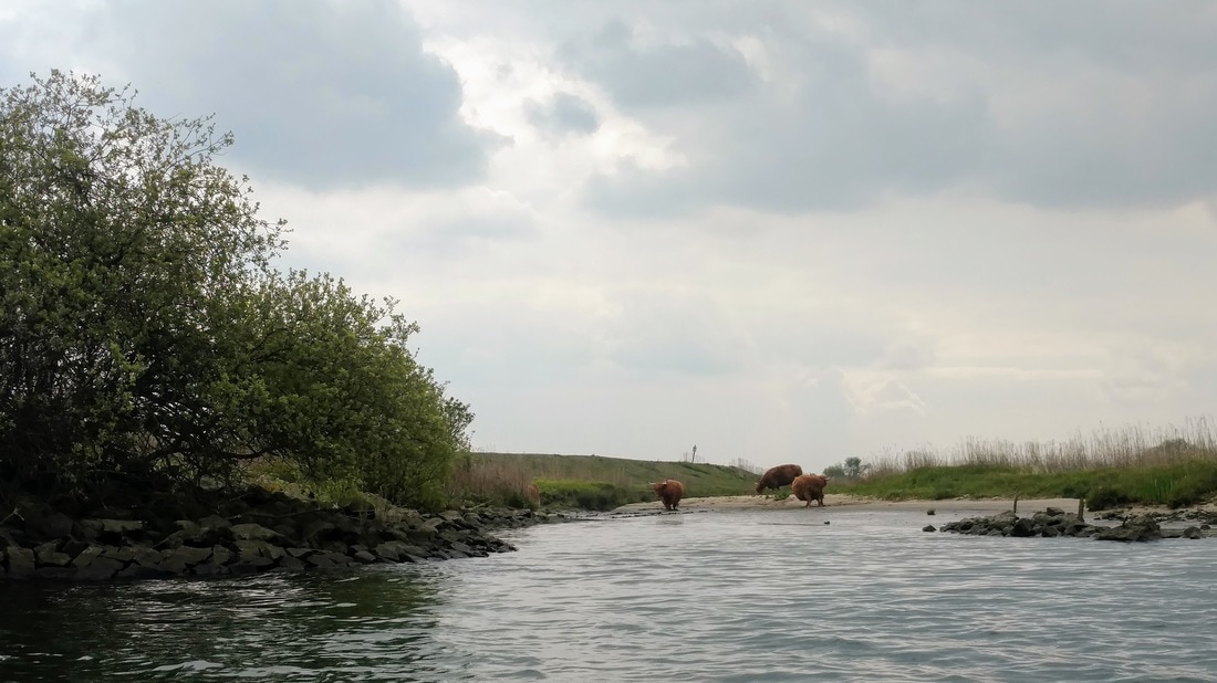
"Wild" Scottish highland cows chilling on the beach.
Along the north side of the island we spotted some "wild" Scottish Highland cows. These were apparently bred back to obtain attributes (long shaggy hair, horns) of an extinct type of Scottish cattle. We saw them chilling on the beach, but if you get too close they get nervous and hide in the tall grasses.
Iede chasing the ferry into the harbor on Tiengemeten
We were hoping to have a coffee or beer at a cafe in the visitor's center, so we paddled into the small island harbor and landed our boats. Upon entering the visitor's center, the only thing available was a coffee machine in the wall (not so gezellig), so after reading some informational signs we departed again. Tom and Iede dropped Amelia and I off on the mainland around 5pm. The girls drove back to Rotterdam and the boys headed back to the island for an evening of camping, beers, and chili con carne (a bit jealous here). I'm looking forward to joining one of the club's overnight trips soon!
I leave you with a couple fun (alternative?) facts about Tiengemeten:
- Since the island was privately owned until 2001, laws of the road did not apply. And since fixing your car was expensive on the island, people would bring cheap old cars and drive them around until they broke. This resulted in a lot of car wrecks lying around the island.
- For 1 year in 1986 the channel to Nieuwendijk couldn't be crossed by ferry, so school children were shuttled by police helicopter!
Date: Saturday, April 29th, 2017
Distance: 21 km (13 miles)
Duration: ~6 hrs (including 1.5 hrs for lunch)
Weather: Cloudy, started out warm and became cool by the end of the day
Distance: 21 km (13 miles)
Duration: ~6 hrs (including 1.5 hrs for lunch)
Weather: Cloudy, started out warm and became cool by the end of the day
 RSS Feed

