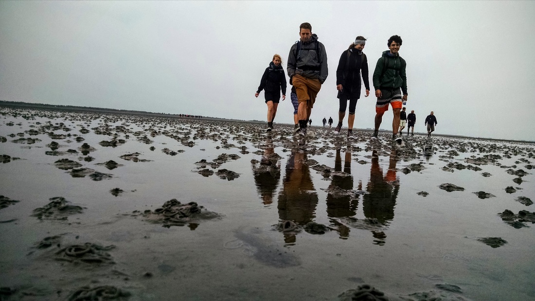
Meet our new band, The Wadlopers
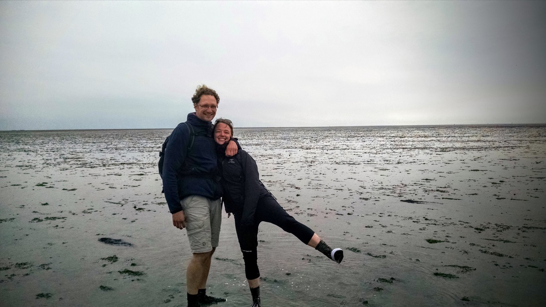
After starting out the weekend with a fantastic cabrewing tour of Lauwersmeer, it was rise-and-shine at 6am on Sunday for a truly Dutch adventure: WADLOPEN. Wad = mudflat, lopen = walking (in Dutch. In Flemish it means running, which would have been ridiculous). While I've done my fair share of mudflat walking as part of my job in California and the Netherlands, I've never attempted it in a recreational way. We put on our rainbow basketball shoes and trudged 16km across bare mudflat to get to Schiermonnikoog, the easternmost Frisian Island in the Netherlands.
|
For those of you not familiar with the coastlines of Northern Europe, the Wadden Sea extends along the coasts of the Netherlands, Germany, and Denmark (see map). These coasts are traced by a string of barrier islands (called the Frisian Islands, or Waddeneilanden). The space between the islands and the mainland is called the Wadden Sea. The Netherlands is home to 5 of the Frisian Islands. The islands are really wonderful places to visit - characterized by naturally evolving dune systems, sandy beaches along their North Sea side, and salt marshes/mudflats on the Wadden Sea side. Since moving to Europe I've visited Texel (see biking blog post), Terschelling, and Ameland. I have yet to visit Vlieland. This past weekend we walked to Schiermonnikoog, the most eastern Frisian Island in the Netherlands.
|
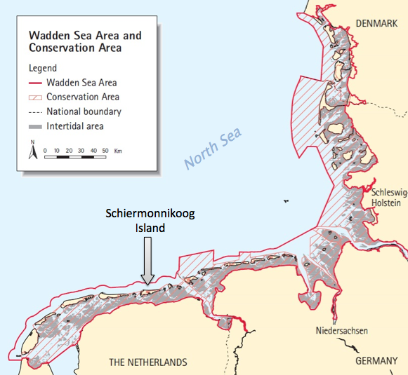
Map originally from the Common Wadden Sea Secretariat
|
As you can see on the map, much of the space between the islands and the mainland is intertidal area, meaning that it usually falls dry during low tide. That means you can walk on it! (If you're careful/prepared, you know what the tide is doing, you time it right, you can navigate, etc. etc.) We signed up for the Brakstrand-Schiermonnikoog wadlopen tour with Wadloopcentrum Pieterburen. For 35 euros you get a 30 min boat ride to the starting point, a 4 hour guided walk, bus shuttle to/from the town on Schiermonnikoog, and a 1 hr boat ride back to the mainland.
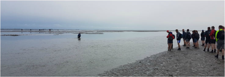
Tour guides testing out where we can cross the biggest tidal channel. This was the spot!
Be Prepared!
How do you prepare for wadlopen? The tour organization's website lists a number of risks associated with wadlopen, including hypothermia and delays. Avoiding delay is critical, as it's only a matter of time (max 6 hours) before the mudflat is covered in 2m of water again! In order to avoid delays, you should wear the right kind of shoes, be in great condition, arrive on time, be prepared for blisters, and have enough food/water/sun protection. It's a bit sobering to think that while these are the same steps you would take for any hiking trip, adding the incoming tide greatly intensifies the consequences. Here's a list of what you're expected to bring:
|
To wear:
|
For during the walk:
|
For after the walk:
|
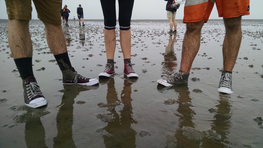
We bought some 8€ pairs of colorful "basketball" shoes (i.e. converse knockoffs) at Bristol. Everyone got a different color, but (spoiler alert!) at the end of the trip they were all the same color, Wadden Sea Grey:
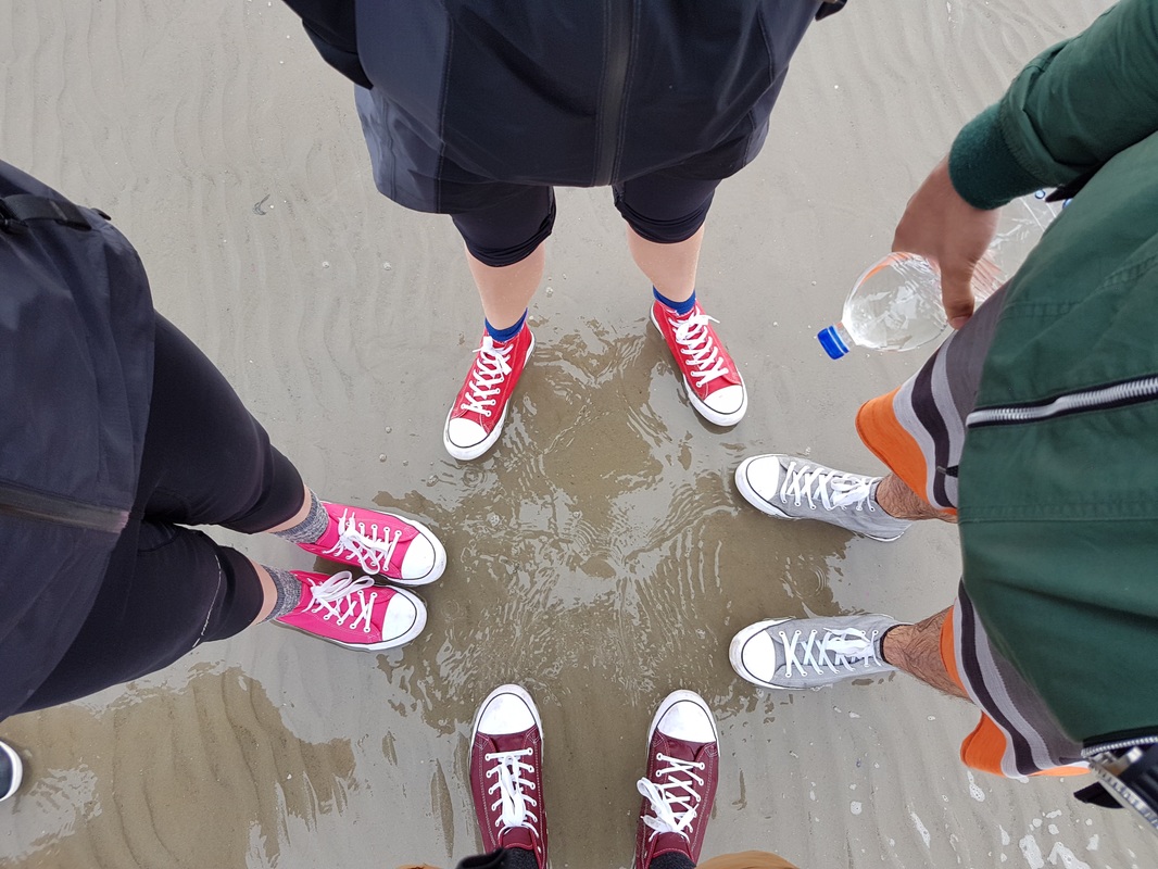
Before
|
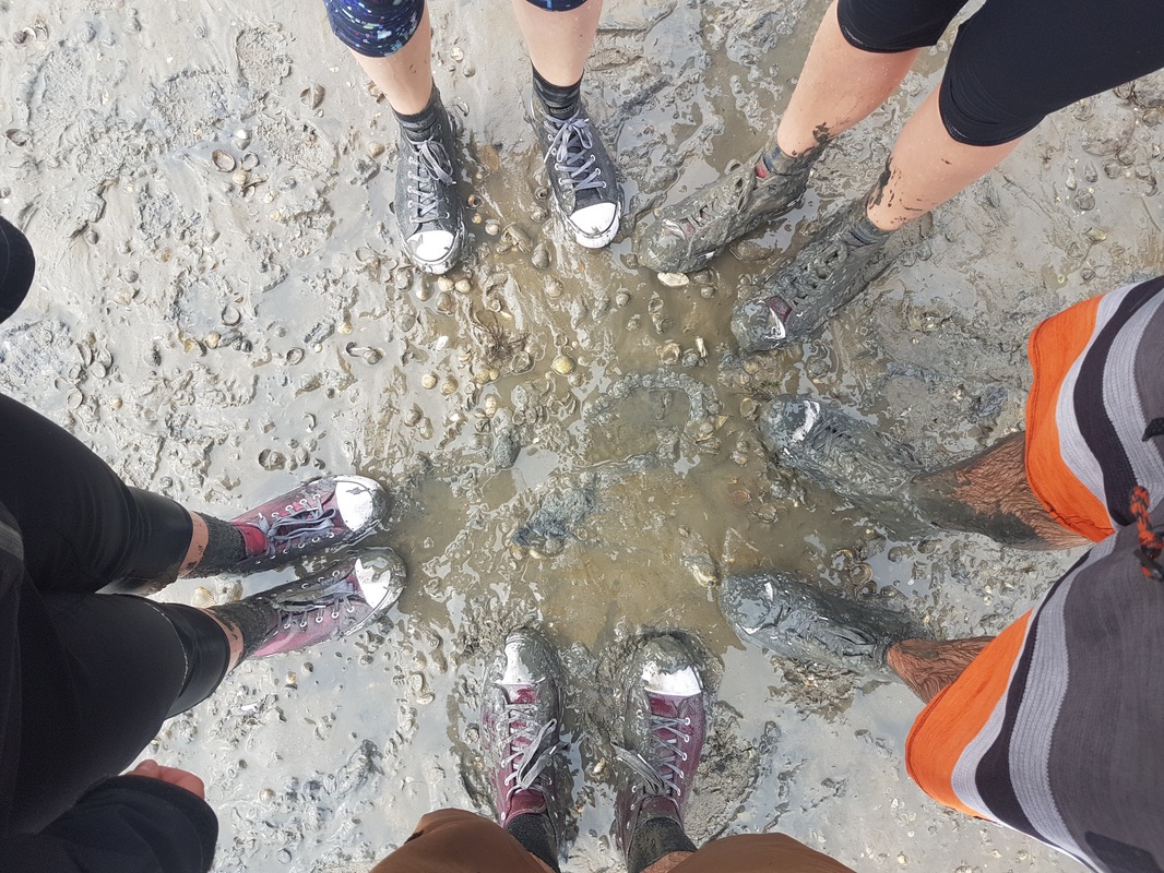
After
|
The Departure
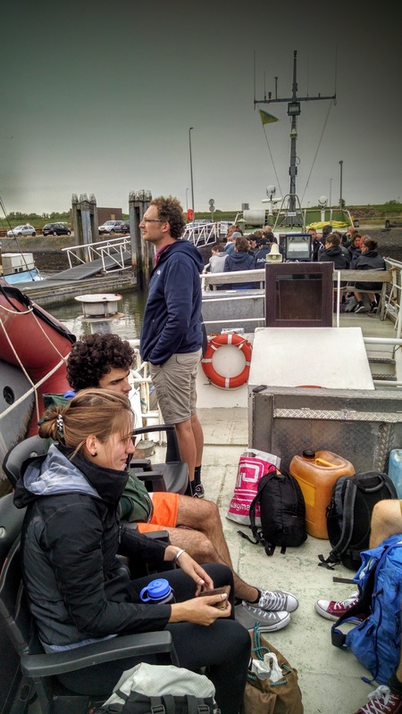
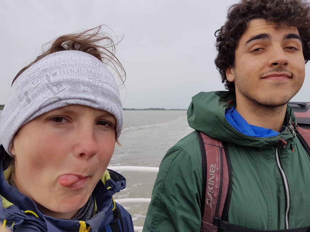
We arrived perfectly on time (7:28am) and boarded the MS Boschwad, taking over the stern deck.
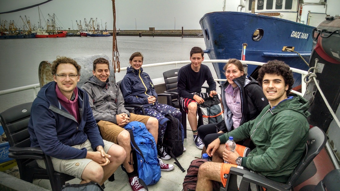
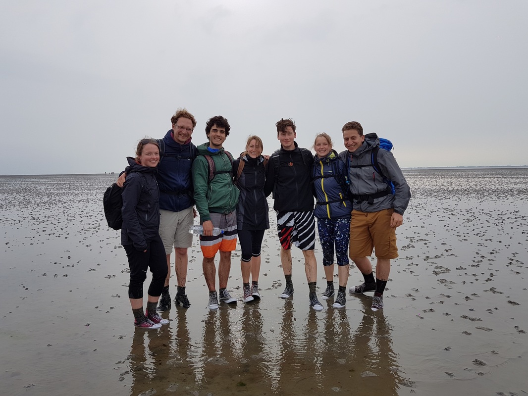
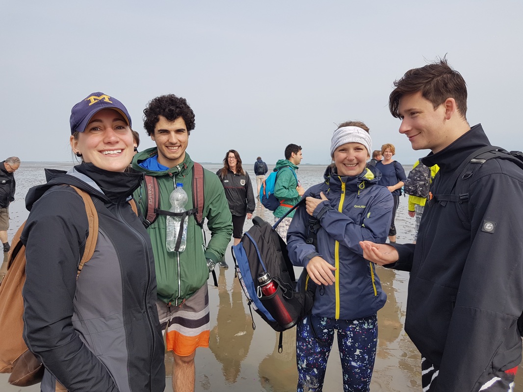
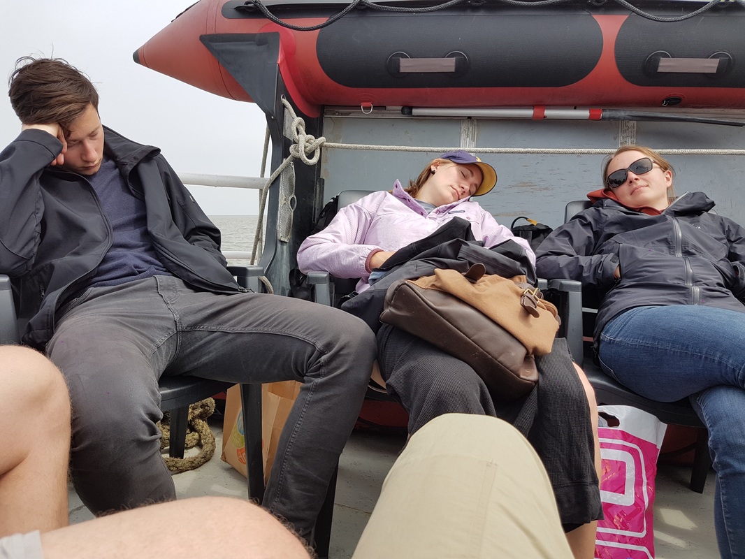
7:30am - The sleepy crew aboard the Boschwad. From left to right: Henk, Sander, Karolina, Martin, Elizabeth, Alex, and Nena behind the camera.
The harbor was quiet, except for one other group of wadlopers heading out on a much smaller boat. We got lucky with the weather - while it was a bit chilly when we weren't walking, we kept more than warm enough once we were on our way. The overcast skies protected from the sun (though we still lathered on the sunscreen to be safe).
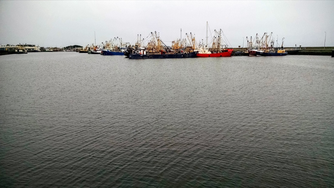
Lauwersoog Harbor. Large, colorful fishing boats abound. I love the patterns on the water in this photo.
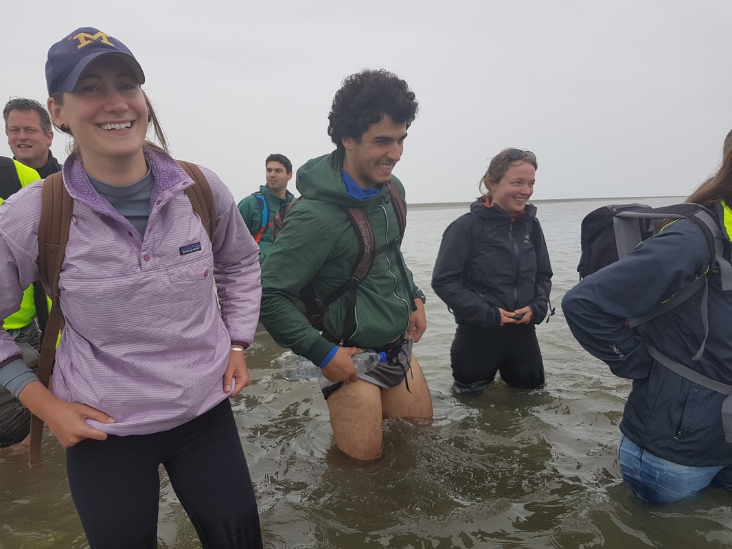
The boat ride to the starting point took about 30 minutes. We were instructed to climb down ladders into the knee deep water. It was less cold than we were expecting, but still chilly!
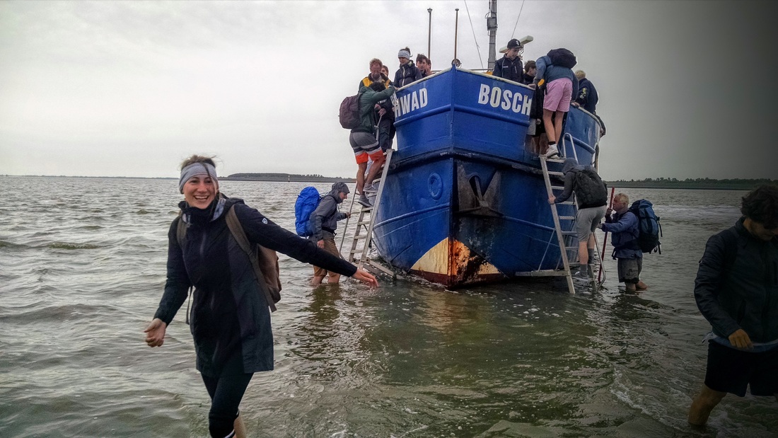
The boat drives up to a sandbar, and we're told to get off. Elizabeth looking more awake now after stepping into the cold Wadden Sea waters. Sander with his giant backpack and Alex heading down the ladder in the background.
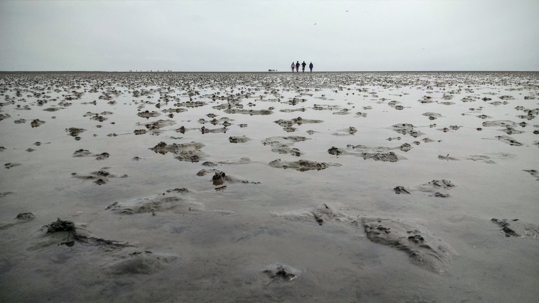
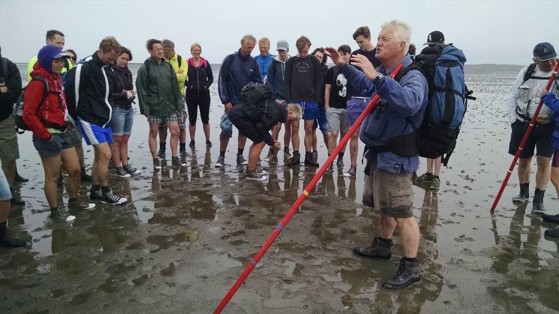
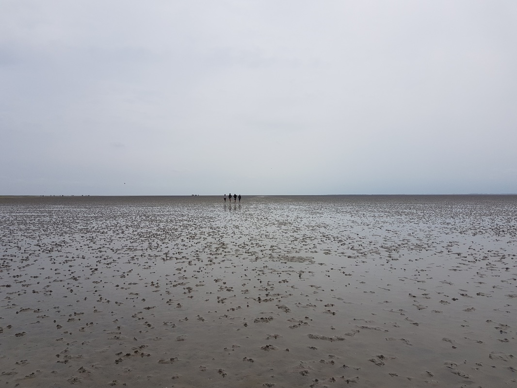
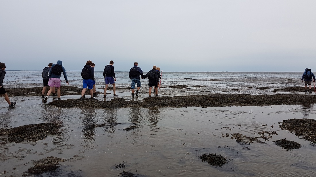
I was surprised by the size of the tour group - I'd estimate that there were about 50 people in total. But this is not such a big deal, since the group quickly spreads out across the mudflat.
Group shot! Mudflats as far as we can see in every direction. Okay, I guess we can see Schiermonnikoog island on the right.
What did we see?
While our tour guides were less engaging than is typical in the US (e.g. they did not tell us anything before/during the boat ride and first hour of the hike, but hey, they're volunteers!), we still learned a bunch about what goes on in the Wadden Sea.
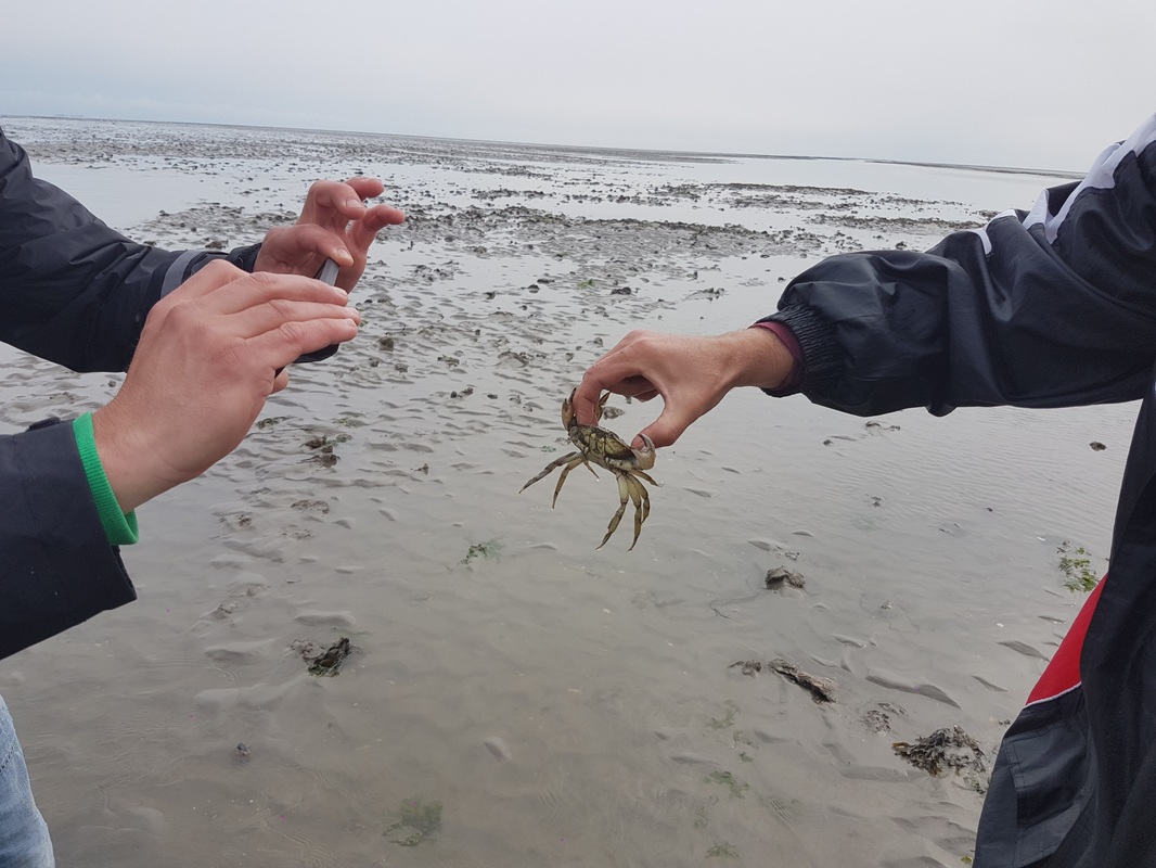
We learned that crabs normally dig into the mud to take shelter during low tide. However, we still saw many crabs lying on the surface, appearing dead. But they're not! They're lying there waiting to shed their shells, which apparently takes 1 to 2 weeks. Then, they gradually grow a new, larger one. Our tour guide was also very excited to explain how crabs have sex, and that male crabs have two penises. Fascinating stuff.
We learned that crabs normally dig into the mud to take shelter during low tide. However, we still saw many crabs lying on the surface, appearing dead. But they're not! They're lying there waiting to shed their shells, which apparently takes 1 to 2 weeks. Then, they gradually grow a new, larger one. Our tour guide was also very excited to explain how crabs have sex, and that male crabs have two penises. Fascinating stuff.
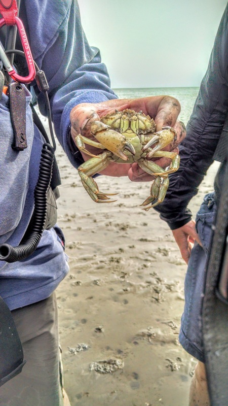
Crabs! This is one of the larger ones we came across.
|
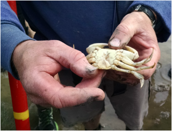
The guide showing us that crabs have two penises.
|
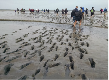
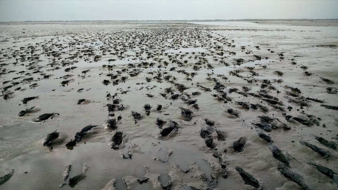
We also learned about the worms that live 10 - 20 cm below the mud surface, filtering mud through their bodies and pooping it out into little mudpiles on the surface (see photos). As we walked, we often saw little squirts of mud popping up on the mud in front of us.
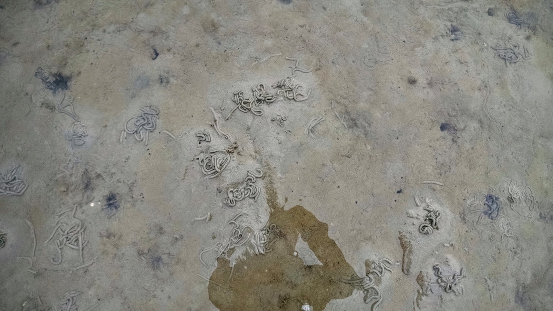
Poop piles from the Lugworm, or "wadpier" in Dutch. The worms live under the sand and eat sand, filter out the nutrients, and poop it back onto the mudflat.
The little mudpiles continuously pooped out by the worms create a lunar landscape. With each 13-hour tidal cycle the landscape is wiped out and recreated anew.
We came across many other cool creatures, like oysters, mussels, clams, all types of jellyfish, and even a shipwreck (okay, a shipwreck is not a creature)! The shipwreck is sometimes visible, and sometimes covered in mud, since the Wadden Sea is always evolving. Tidal channels get deeper and move around, and mudflats grow and shrink. It's different every day! I wish I'd taken more photos so I could show you. For now you'll have to be entertained by this video of a purple pulsating jellyfish:
|
|
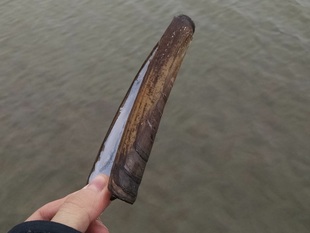
Razor clams!
|
Is wadlopen hard?
To give you an idea of what we experienced during our walk, I put together 4 photos that represent pretty much all the conditions we encountered. They're also rated by level of difficulty, with 1 being the easiest.
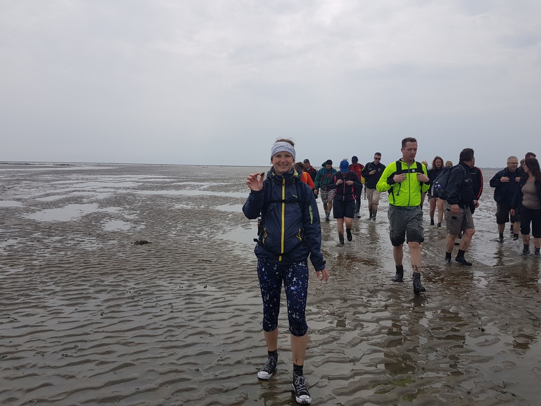
Level 1: Sand. Solid, easy to walk on. I could do this all day! Here's Karolina showing us one of the many clams she picked up along the way for dinner.
|
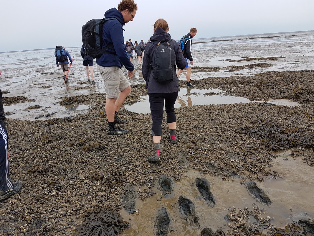
Level 2: Oyster/mussel beds. Solid, super sharp. Easy to walk on, but pay attention to where you step (watch out for crabs!).
|
Level 3: Mud. Soft, sticky, and slippery. Move quickly or you'll sink deeper. But don't move too fast or risk a muddy butt!
|
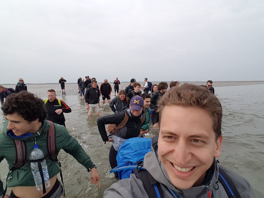
Level 4: Deep tidal channels. Deep, moving water. Up to waist deep during our trip. Don't fall in, or you and your dry clothes will be quite damp!
|
The tides
On a nerdier note, I downloaded the predicted tides from getij.rws.nl (the actual water levels aren't available yet). In the figure below I've marked the start and end times of our walk. As you can see, we started when the tide was on its way down, and ended when the tide was on its way up. If we had waited another 2 hours, the water would have been over our heads at the tidal channel crossings.
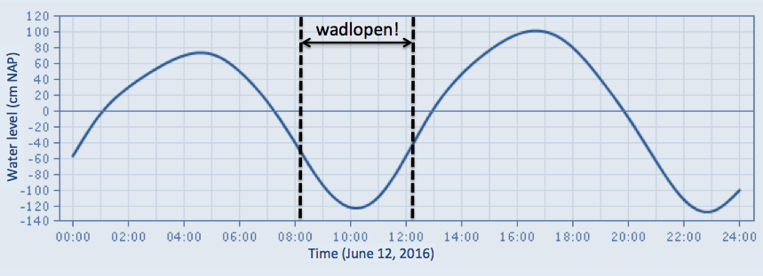
FYI, NAP on the Y-axis is Normaal Amsterdams Peil (normalized Amsterdam datum), which is the vertical datum that water levels are referenced to in the Netherlands. Amsterdamse Peil was first defined in 1684 as the average water level observed in the IJ River (which flows through Amsterdam) from september 1683 to september 1684. The datum was normalized/corrected in 1894. In the US we usually use NAVD88 (North American Vertical Datum of 1988), which is an updated version of NGVD29 (National Geodetic Vertical Datum of 1929).
More photos from the walk (click to enlarge)
Sander and I shared photography duties on this trip, so the photos in this post are a mix of our photos :)

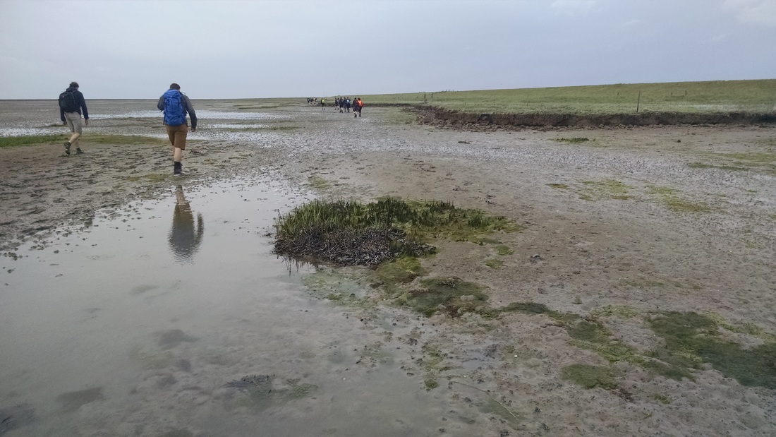


Arrival to Schiermonnikoog Island
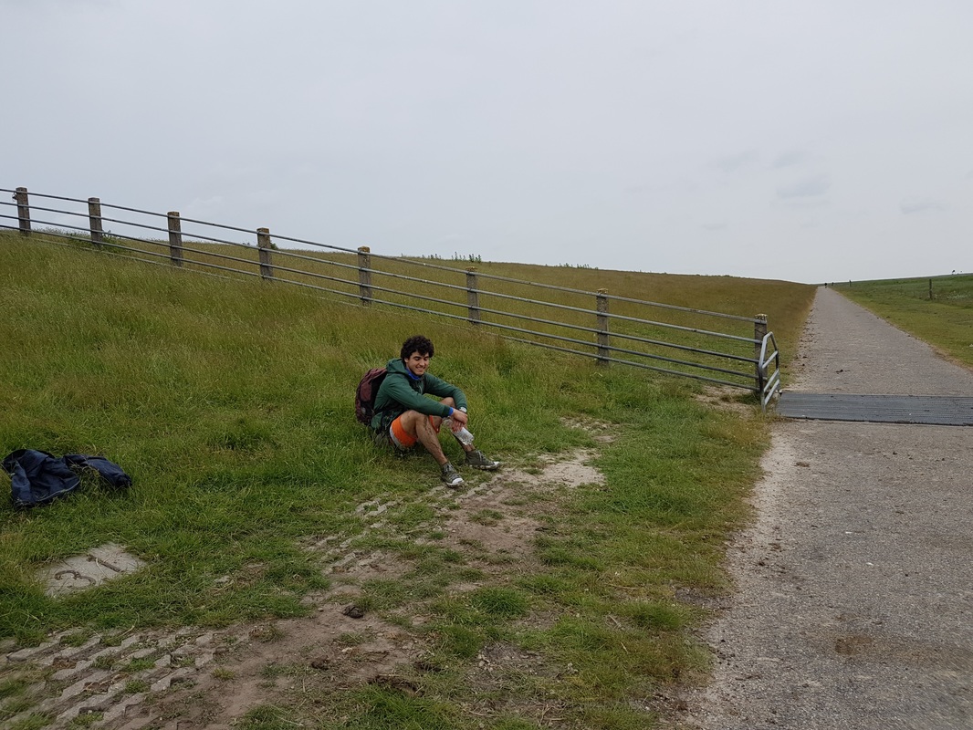
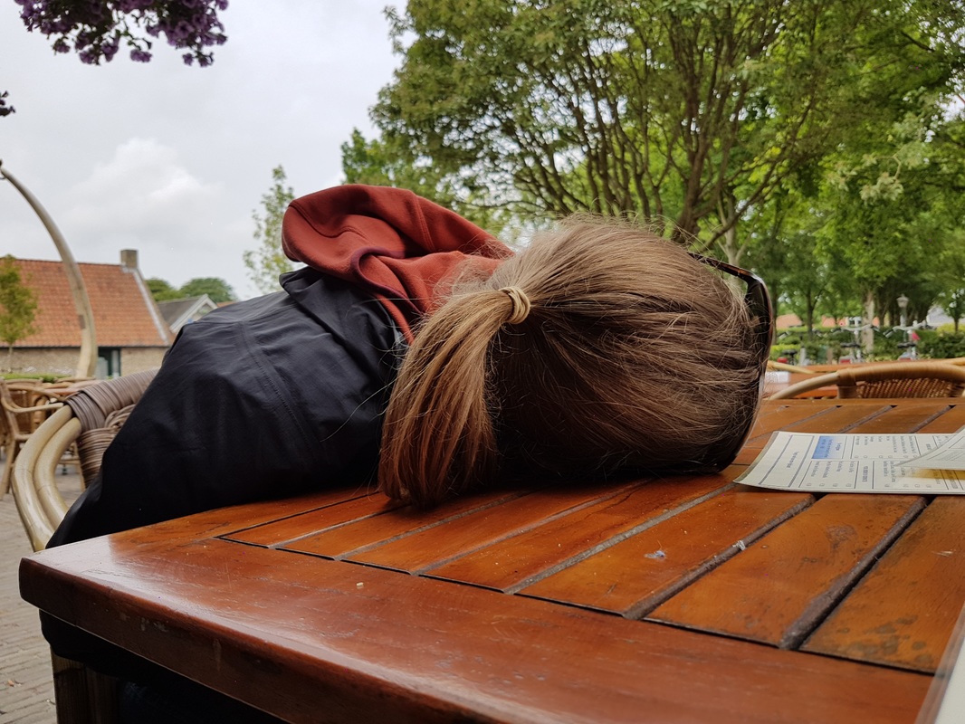
As you'll see in our route map at the end of this post, the walk took us far east and back west, in order to avoid some deep tidal channels. The last part of the walk feel very long, as we kept walking along the island in slippery mud, waiting for a spot where we could access land without getting zapped by an electric fence (lots of cows venture into the mud and get stuck). When we finally arrived, we were herded to a washing station, where we shed and rinsed our muddy clothes. A bus picked us up and brought us to town, where we huddled in a pavilion, ate lunch, and watched the rain (which was perfectly timed to start once we were under a roof!). We stuffed our faces with french fries, vegetables, and ice cream. We attempted to get coffee/beer at a local cafe, but no one would serve us, so we slept on the table instead... The sun came out just in time for our boat ride back to the mainland, and everyone basked/snoozed for the hour back. Those unfortunate enough to be awake attempted to dodge seagull poop, thanks to a few other tourists who decided that feeding them was a great idea!
... then, a 3 hour car ride + 1 hour train ride later, I was back in my apartment in Antwerp, Belgium. and TOTALLY POOPED! What an awesome weekend :)
... then, a 3 hour car ride + 1 hour train ride later, I was back in my apartment in Antwerp, Belgium. and TOTALLY POOPED! What an awesome weekend :)

Route Map
Date: Sunday, June 12, 2016
Distance: ~14 km (~8.7 miles)
Duration: 4 hours
Weather: Cool and cloudy (luckily!!)
Distance: ~14 km (~8.7 miles)
Duration: 4 hours
Weather: Cool and cloudy (luckily!!)
 RSS Feed

