The Naked Kayaker
  • Blog
    • Search the site
  • Resources
    • Complete List of Posts
    • Trip Planning 101
    • Intro to Kayaking - Course Outline
    • Where can I rent a kayak in Belgium/the Netherlands?
    • How do I get certified in NL?
    • Map of Paddling Clubs
    • Dutch-English Watersports Dictionary
  • Destinations
    • West Coast
    • Great Lakes Region
    • New York State
    • New England
    • Europe
    • Oceania
  • Water Nerd
  • About & Contact

Blog

"Believe me, my young friend. There is nothing, absolutely nothing,
half so worth doing as simply messing around in boats." 

The Wind in the Willows

Soaking up a bit of history and sun in the Biesbosch wetlands

4/13/2015

0 Comments

 
Picture
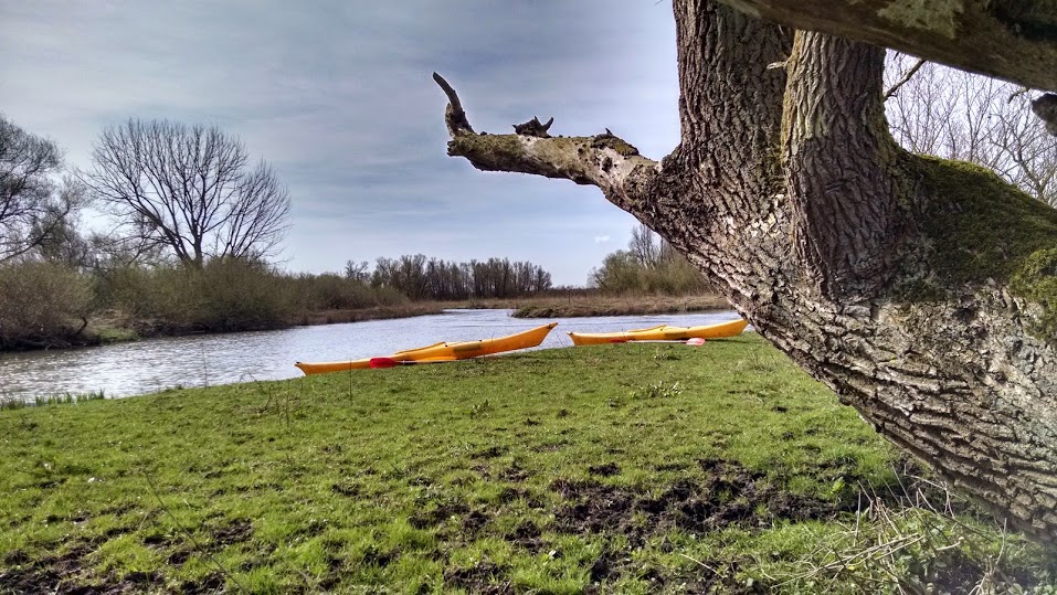
First break, sitting on a log.
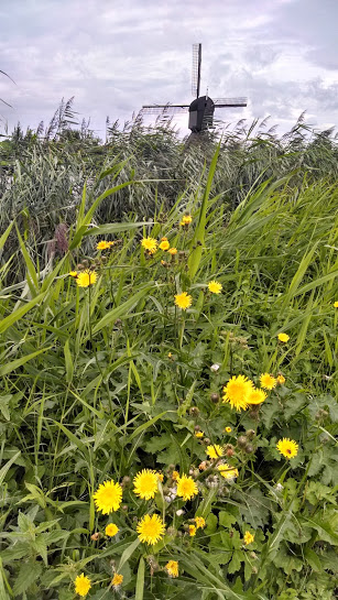
The Biesbosch is a national park in the Netherlands, located about 30 minutes (drive) southeast of Rotterdam. On Sunday, Henk Jan and I hopped in the Beast (his 400k mile Volvo) and drove down to the Biesbosch for a day of kayaking. The Biesbosch is best explored by boat, since it consists of endless channels that weave around low-lying islands. The Biesbosch has a long history of inhabitants and water management. I'll tell you about that at the end of this post. We spent about 5 hours paddling through the channels, ending up with a solid 11-mile paddle for Henk Jan's first time in a kayak...

Read More
0 Comments

Roadtrippin' through the Dutch Delta Works

2/16/2015

0 Comments

 
Picture
The Oosterscheldekering
Water nerd alert! No kayaking in this post. 

One year after the deadly floods of 1953, which killed over 1,800 people, the Dutch began construction on the Delta Works - the largest flood protection system ever constructed. The "Delta Works" generally refers to 13 storm surge barriers (stormvloedkeringen) and dams (dammen) constructed between 1954 and 1997. 

In a previous post, I described the Maeslantkering, which was the final barrier completed. Yesterday, Henk Jan and I went on a roadtrip through the provinces of South Holland and Zeeland to visit 3 more structures: Haringvlietsluizen, Brouwersdam, and the Oosterscheldekering. Read on...

Read More
0 Comments

Dutch Kayaking and Canoeing Vocabulary

1/12/2015

6 Comments

 
[I wrote this post back in January 2015, but I keep it updated each time I learn something new! I will add sailing terms soon!]

While I consider myself a fairly fluent Dutch (/Flemish) speaker, I was surprised at my limited kayaking vocabulary when I first joined the Windhappers kayaking club last September. It's hard to convince someone that you're a competent paddler when they ask you if you know how to do a boogslag (sweep stroke) and you return a blank stare. In the same vein, many of the otherwise-fluent English speakers did not recognize the English terms that I offered up in an effort to reach a mutual understanding. 

So, to shrink this gap in communication for myself and anyone else in the same boot, I put together this list of common kayaking and canoeing terms. A big thanks to Tim, Leon, Sytse, Eric, and Jan of the Windhappers for helping me translate the more challenging words. It's a work in progress. Please contact me if you find an error or have suggested additions. Click Read More to see the list of terms!

Read More
6 Comments

A Stroll to the Oosterschelde Oyster Reefs

10/5/2014

1 Comment

 
This was the first field visit for the EMERGO project, a project by TU Delft and NIOZ (the Netherlands Institute of Sea Research) that I'll be working on during my time in the Netherlands. The overarching goal is to understand the morphological and ecological responses of tidal flats to different restoration measures. The project was sparked, in part, by the ongoing loss of intertidal habitats (tidal flats, oyster reefs, marshes, sea grasses) in the Oosterschelde. Between 1976 and 1986, a storm surge barrier was constructed across the mouth of the river. This barrier was the largest component of the 50 year Delta Works flood management project to protect the Netherlands from flooding after devastating floods in 1953. Stay tuned for a future post about this barrier - an epic bike trip is in the works that will involve biking across many of the storm surge barriers.

Anyways, the barrier reduced the tide range in the river (i.e. the tide does not go as high or as low as it used to). Since intertidal habitats depend on being dry and wet for a certain amount of time, this smaller tide range has lead to rapid shrinking and loss of tidal flat and marsh habitat. Many pilot projects are in the ground already to test ways to slow/stop this degradation, including artificial oyster reefs and tidal flat sand replenishments. The EMERGO project will look at how well these (and other) actions address the unraveling of intertidal habitats.

Let's visit some artificial and natural oyster reefs!

Picture
EMERGO project team: Bram, Lodewijk, Tom, and Oliver
My first impression of tidal flats in the Oosterschelde (Eastern Scheldt), a major river in South Holland, was the ease with which you could walk across them. In San Francisco Bay, where the tidal flats are muddy (rather than sandy), each step sank deep into the mud. The crossing to the oyster restoration site for monthly monitoring was always an exhausting adventure. Tuesday's visit to the tidal flats of the Oosterschelde brought back fond memories of tromping through the mud in California.

How can oyster reefs help restore the Oosterschelde?


Read More
1 Comment

Maeslantkering: Testing a Storm Surge Barrier

10/1/2014

0 Comments

 
Picture
Animation of the Maeslantkering in action (Source)
Once a year, Rijkswaterstaat does a test closing of the Maeslantkering, a massive storm surge barrier on the waterway that connects Rotterdam to the ocean (the Nieuwe Waterweg/the Scheur). Check out the structure in Google Maps. Rijkswaterstaat is the government agency that oversees flood protection in the Netherlands by building and maintaining the complex and highly managed system of rivers, lakes, coastlines, pumps, and flood protection structures. This is necessary because more than 25% of the country is below sea level (protected by dikes). This was one of the last projects within the 50-year Delta Works, a massive flood infrastructure project triggered by the devastating 1953 floods that killed almost 2000 people.

Read More
0 Comments

Windmills at Kinderdijk

8/25/2014

0 Comments

 
Picture
Guest blog post by Bridget! My comments in [italics], as usual :)

On Friday we woke up early to do my favorite activity – looking at windmills! We decided to go to Kinderdijk, a UNESCO World Heritage site, where a complex of windmills were built to prevent the flood-prone region from flooding. I don't want to bore you with all the history here [THIS IS NOT BORING! People have lived in this region for a long time, and until the 13th century it was dewatered (by humans) using gravity. Since it is naturally a peat bog, dewatering led to decomposition of the peat (when peat is exposed to oxygen it breaks down and releases carbon into the atmosphere), which makes the ground sink over time. Now lower, the region flooded more often. The inhabitants built levees and water storage ponds, where they could store flood water. The 19 windmills at Kinderdijk (built in the mid 1700s) served to pump water from low-lying areas into these storage ponds. Today, the windmills have long been replaced by electrical pump stations and the mills remain for tourist enjoyment.] If you are interested to learn more, you can find a good description on this website: www.kinderdijk.com...

Read More
0 Comments

De Zandmotor, Herring, and the Girl with the Pearl Earring

8/23/2014

0 Comments

 
Picture
Last Wednesday was a day of all-things-Dutch. Again, no kayaking. But there is kayaking on the horizon, so stay tuned!

Bridget and I made a day trip to the Zandmotor - a massive beach nourishment project on the South Holland coastline. Very exciting for a coastal engineering nerd like me.

But if that's not exciting enough for you, we also recreated a famous painting: The Girl with the Pearl Earring. Maybe you've heard of it? :)

Read More
0 Comments

"Wringing" the New Year with the King Tides

2/23/2014

3 Comments

 
Picture
Extreme low tide
Picture
Extreme high tide
[This post has been in draft form for 1.5 months, so I figured it was time to accept its imperfections and wrap it up. Lindsey, my fellow king-tide tour-guide also wrote a post, available here]

Choose inundation over inebriation** and celebrate King Tides because it's much more exciting than celebrating the New Year. Why? [Thanks to Lindsey for helping brainstorm this list]
  1. The party don't stop: They happen for 3 days, so you can "Cheers!" and wish everyone a HAPPY KING TIDE at least 3 times. And since they happen in different places at different times, you can chase the tide and have that exciting moment multiple times in a day.
  2. The party don't stop #2: Another good reason to drink at the Embarcadero 
  3. Play; Splashing in puddles an getting hit by waves in normally dry places.
  4. Excitement: Fleeing men in golf carts
  5. See the future: See what the world will look like every day with sea level rise. 
  6. And, because this is a kayaking blog... Expanded kayaking territory. As the water rises, it moves into nearby low-lying areas that are not normally wet, creating new spaces for kayakers to explore. 
** A wonderful expression coined by James Jackson

So... what are King Tides...?

Read More
3 Comments

Dinoflagellate Discoveries, Sponsored by Bud Light Lime

12/9/2013

1 Comment

 
Picture
Approaching Hog Island at dusk. Photo © 2013 Joël Thai
Today I'm digging into the archives to recount my first true overnight kayak camping trip in California (sad, I know). Beth, Sara, Eddie, Joel, Christina, Brian, Alice, and I camped overnight at Tomales Beach in Tomales Bay. Dane + 2 friends joined us for the Saturday paddle and lunch.

Read More
1 Comment

A Tribute to the Earthen Dam

10/1/2010

1 Comment

 
Picture
The top of the dam to the left, the reservoir to the right.
...A mini lesson in hydrology by Emily and Nena! Click "Read More" for sweet movies!

I apologize in advance: This is not a post about kayaking... It is, however, related to the outdoors and water.

Last fall I took a really interesting class called "Watershed Engineering," in which we analyzed and designed water control structures (dams, culverts, channels, etc). One of our projects was to analyze the Virgil Creek earthen dam.  For some unknown reason, a few of us fell in love with the dam, and have been back to visit (and camp out...) a few times... The slope of the dam makes a perfect angle for watching meteor showers...

Read More
1 Comment
Forward>>

    Welcome!

    This is a blog about exploring the outdoors (mostly by kayak), traveling, trip planning, and coastal engineering. It currently focuses on kayaking in the Netherlands and Belgium, but previous posts cover Upstate New York, California, and much more. See the Complete List of Blog Posts for a history of the site. Looking for something specific? Search the site here.

    In addition to the blog, check out the Water Nerd section, where I write about coastal engineering and hydrology. 

    ​Happy Paddling!
    ​Nena

    Subscribe Here!

    Email updates on new blog posts, about once per month.

    Reader Tips

    Click the "Read More" link at the bottom of each summary for more photos, to see an interactive map of the route, and to read about the adventure.

    Maps in each blog post: Click the icons to learn more about the launch site (amenities) and destinations. Click the square in the bottom-left corner to see an aerial photo behind the route.
    Suggestions much appreciated!


    Archives

    December 2020
    April 2019
    November 2018
    October 2018
    September 2018
    August 2018
    July 2018
    March 2018
    February 2018
    January 2018
    December 2017
    November 2017
    August 2017
    July 2017
    May 2017
    April 2017
    March 2017
    September 2016
    August 2016
    July 2016
    June 2016
    May 2016
    March 2016
    December 2015
    November 2015
    June 2015
    May 2015
    April 2015
    March 2015
    February 2015
    January 2015
    November 2014
    October 2014
    September 2014
    August 2014
    July 2014
    June 2014
    May 2014
    April 2014
    March 2014
    February 2014
    December 2013
    June 2013
    May 2013
    December 2012
    November 2012
    June 2012
    May 2012
    May 2011
    November 2010
    October 2010
    September 2010
    August 2010
    July 2010
    June 2010
    May 2010


    Categories

    All
    Biking
    Camping
    Canoeing
    City Trip
    Distance: 00 - 05 Miles
    Distance: 05 - 10 Miles
    Distance: 10 - 15 Miles
    Distance: 15 - 20 Miles
    Distance: > 20 Miles
    Guest Post
    Hiking
    Kayak Polo
    Reflections
    Region: Belgium
    Region: California
    Region: Canary Islands
    Region: Croatia
    Region: France
    Region: Great Lakes
    Region: Greece
    Region: Italy
    Region: Netherlands
    Region: New York
    Region: New Zealand
    Region: Norway
    Region: Oregon
    Region: Portugal
    Region: Spain
    Region: Switzerland
    Region: UK
    Region: US East Coast
    Region: Vancouver
    Region: Washington
    Roadtrip
    Tide: Non-Tidal
    Tides: Non-Tidal
    Tides: Tidal
    Time Capsules
    Trip Planning 101
    Type: Bay
    Type: Canal
    Type: Channel
    Type: Fjord
    Type: Lake
    Type: Lake/Reservoir
    Type: Open Coast
    Type: River
    Water Nerd

    RSS Feed

    Click the RSS Feed link, copy the URL, and paste it into your favorite feed reader.
    Blog Expat: living abroad

    Expats Blog
© 2021 The Naked Kayaker. All rights Reserved.